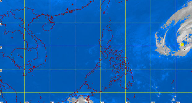
MT Satellite image March 17, 2015 7:01 a.m. Screengrab from https://pagasa.dost.gov.ph/index.php/
MANILA, Philippines–Tropical storm “Bavi” may make landfall in Central or Northern Luzon on Friday, Panahon TV said.
The storm neared Philippine area of responsibility (PAR) on Tuesday morning and is expected to enter within the day.
Gener Quitlong of the Philippine Atmospheric, Geophysical and Astronomical Services Administration (Pagasa) said there are two scenarios for Bavi, which will be called “Betty” once it enters PAR.
The storm could make landfall by Friday or Saturday in Northern or Central Luzon or it could continue to weaken and dissipate in the following days before it hits land, Quitlong said.
Bavi was last observed 1,430 kilometers east of Bicol region, packing maximum sustained winds of 65 kilometers per hour and gusts of up to 80 kph.
Warm weather is seen in Northern Luzon due to a ridge of high pressure area.
The entire archipelago will experience partly cloudy to at times cloudy skies with isolated rains or thunderstorms, Pagasa said.
RELATED STORIES
Tropical storm ‘Bavi’ slows down, to enter PAR Tuesday
Tropical Storm ‘Bavi’ may intensify to typhoon on Wednesday