

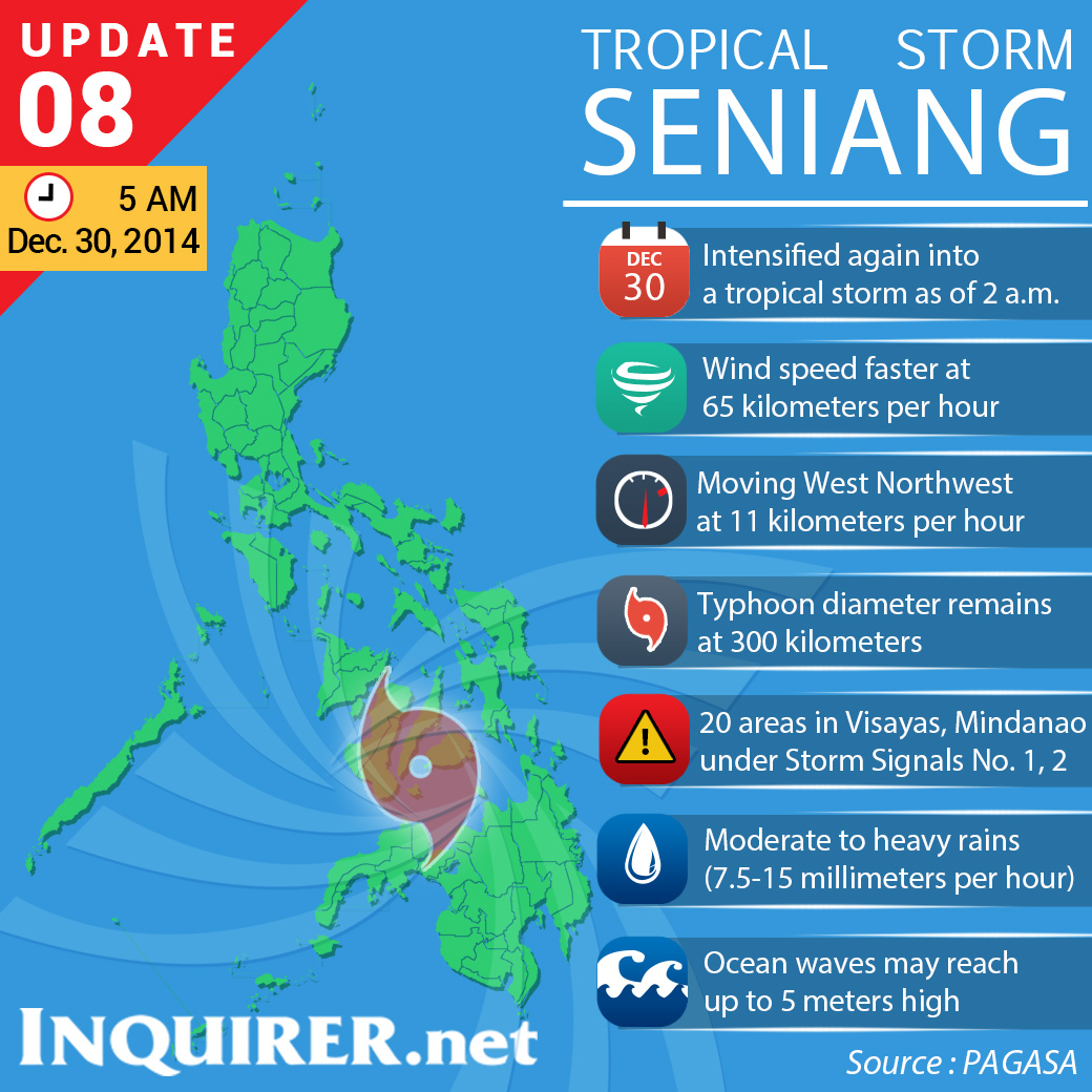
MANILA, Philippines — Tropical Storm “Seniang” continued to pummel central and southern Philippines as it approached Cebu Tuesday morning, the weather bureau said.
In its 5 am bulletin, the Philippine Atmospheric, Geophysical and Astronomical Services Administration (Pagasa) said Seniang was spotted at 4 am about 35 kilometers southeast of Mactan, Cebu City.
Seniang was tracking a west-northwest path at a pace of 11 kilometers per hour while packing maximum sustained winds of 65 kph and gusts of 80 kph.
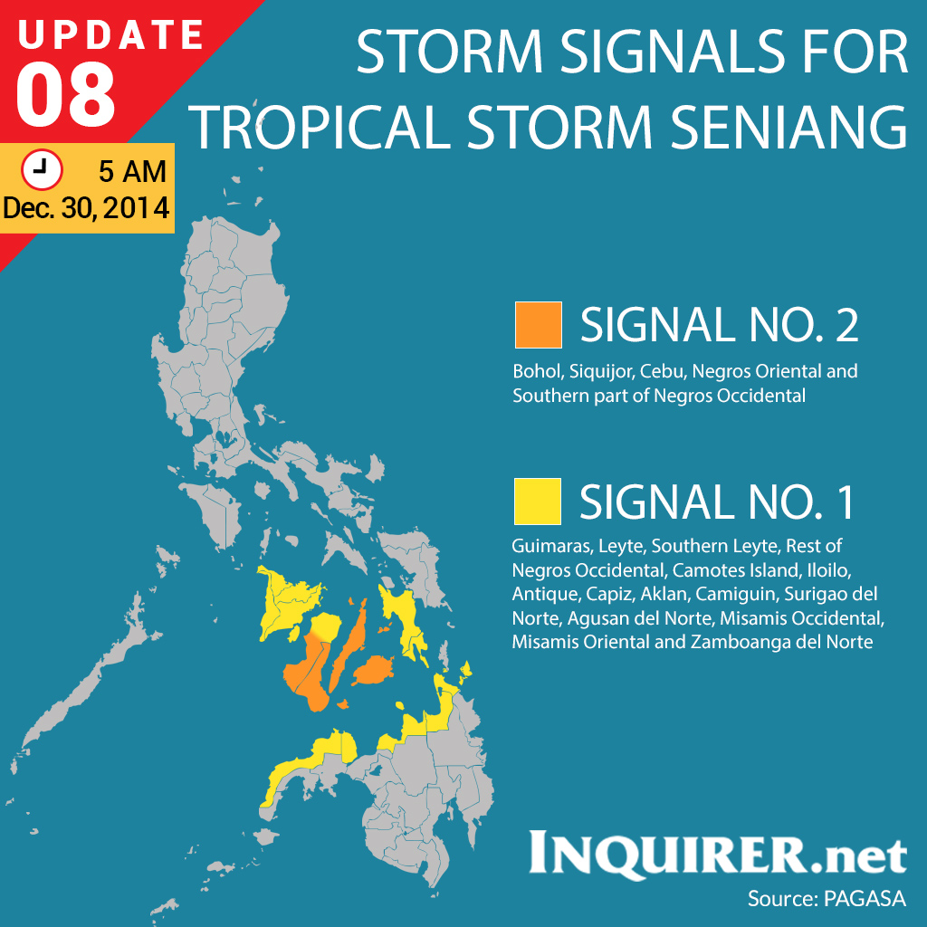
Subsequently, Pagasa placed Bohol, Siquijor, Cebu, Negros Oriental and the southern part of Negros Occidental under public storm warning signal number 2.
Affected areas would experience stormy weather with heavy to intense rains, prompting Pagasa to warn residents in low-lying and mountainous communities against landslides and flashfloods.
These provinces can expect moderate to heavy rains with occasional intense downpours that may cause flashfloods or landslides, Pagasa said.
RELATED STORIES
‘Seniang’ again intensifies into tropical storm