Tropical Storm ‘Seniang’ weakens into tropical depression | Inquirer News

Tropical Storm ‘Seniang’ weakens into tropical depression
/ 12:31 AM December 30, 2014

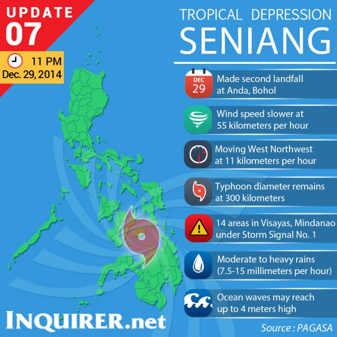
TYPHOONPROFILESENIANG-Dec29-14-11pm SENIANG_SIGNALS_12292014_11pmMANILA, Philippines–Tropical Storm “Seniang” has weakened into a tropical depression after it made a landfall over Andal, Bohol, the state weather bureau said in its 11 p.m. bulletin on Monday.

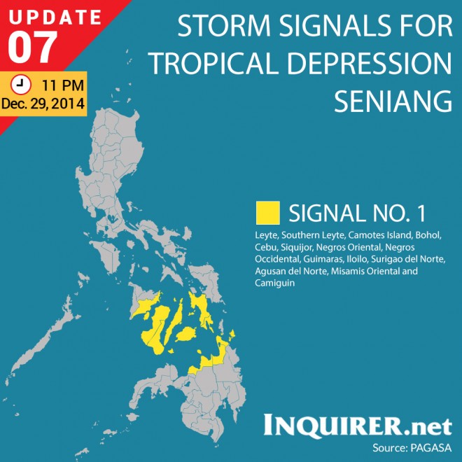
With Seniang now packing maximum sustained winds of 55 kilometers per hour (from the previous 65 kph), the Philippine Atmospheric, Geophysical & Astronomical Services Administration (Pagasa) lifted Public Storm Signal No. 2 in previously named areas. It raised Public Storm Signal No. over Leyte, Southern Leyte, Camotes Island, Bohol, Cebu, Siquijor, Negros Oriental, Negros Occidental, Guimaras, Iloilo, Surigao del Norte, Agusan del Norte, Misamis Oriental and Camiguin.

In areas under Signal No. 1, winds of 30 to 60 kph are expected in 36 hours. These areas will have moderate to heavy rains with occasional gusty winds. Pagasa warned residents in low-lying and mountainous areas to be on alert for possible flashfloods and landslides.

Article continues after this advertisement

Pagasa said ocean waves may reach up to 4 meters.

FEATURED STORIES

RELATED STORIES

‘Seniang’ maintains strength; Signal No. 2 up in 11 areas

Article continues after this advertisement

2 die as ‘Seniang’ sweeps through Mindanao

Seniang now a tropical storm; slams NE Mindanao

Your subscription could not be saved. Please try again.
Your subscription has been successful.

Subscribe to our daily newsletter

By providing an email address. I agree to the Terms of Use and acknowledge that I have read the Privacy Policy.

TAGS: Philippines, Seniang, Weather

Your subscription could not be saved. Please try again.
Your subscription has been successful.

Subscribe to our newsletter!

By providing an email address. I agree to the Terms of Use and acknowledge that I have read the Privacy Policy.

© Copyright 1997-2024 INQUIRER.net | All Rights Reserved

This is an information message

We use cookies to enhance your experience. By continuing, you agree to our use of cookies. Learn more here.