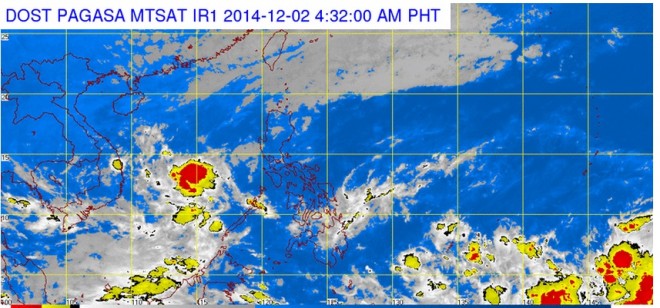
Pagasa: Cyclone headed toward PH

But forecasters from the Philippine Atmospheric, Geophysical and Astronomical Services Administration (Pagasa) see a slim chance the cyclone, to be named “Ruby” once it enters the PAR, will make landfall.
Expect cloudy weather on Tuesday, Pagasa said, with Metro Manila, Calabarzon and Aurora having light to moderate rainshowers and thunderstorms. Cagayan Valley, Apayao and Ilocos Norte will also have light rains, while most of the country’s eastern section will have isolated rainshowers and thunderstorms.
Coastal waters off Luzon and eastern Visayas will be moderate to rough, while elsewhere they will be slight to moderate.
Hagupit quickly intensified on Monday from a low pressure area (LPA) to a tropical storm with winds of up to 80 kilometers per hour as it sped toward the country in a west northwest direction at 25 kph.
As of Monday night, the eye of the storm was estimated around 3,000 km from eastern Mindanao, according to Pagasa.
Article continues after this advertisement“It may intensify and become a typhoon by Thursday or Friday” when the cyclone is expected to enter the PAR,” forecaster Samuel Duran said.
Article continues after this advertisementForecast models showed the approaching storm will most likely remain at sea, though “there’s a small chance it will make landfall in the Visayas,” Duran said.
The Visayas and Mindanao have barely recovered from Tropical Storm “Queenie” last week and from the LPA that immediately formed upon Queenie’s exit on Friday. The LPA dissipated by Monday.–Dona Z. Pazzibugan