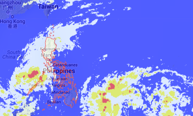
MANILA, Philippines—Tropical depression Queenie is moving towards the West Philippine Sea and is expected to exit the Philippine area of responsibility on Friday while another low pressure area was spotted near Mindanao.
The tropical depression has crossed Northern Palawan and was last observed 120 kilometers north of Puerto Princesa City, the Philippine Atmospheric Geophysical and Astronomical Services Administration said in a 5 a.m. bulletin.
Palawan including Calamian Group of Islands and Cuyo Islands remained under Signal No. 1.
Queenie maintained its maximum sustained winds of 55 kilometers per hour and continued to move west northwest at 24 kph.
It is expected to exit PAR between 7 p.m. and 8 p.m., Pagasa said.
Moderate to heavy rains are forecast within the 300 kilometer diameter of Queenie.
Fisherfolk and those with small vessels were advised not to use the seaboard of Palawan.
The new LPA, meanwhile, was spotted 1,000 kilometers east southeast of Southern Mindanao.
RELATED STORY
‘Queenie’ kills two; to hit Palawan Friday night
