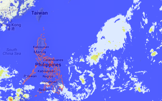
LPA not likely to become cyclone but will still bring rains to Visayas—Pagasa
MANILA, Philippines—A low pressure area (LPA), which entered the Philippine area of responsibility (PAR) on Tuesday, would not likely evolve into a cyclone but would still bring rains to parts of the Visayas on Thursday or Friday during its approach to the country’s landmass, the Philippine Atmospheric, Geophysical and Astronomical Services Administration (Pagasa) said.
Forecaster Meno Mendoza said the LPA, not seen to develop into a tropical depression because of its weak circulation, could even dissipate when making landfall.
“We expect the LPA to affect the Visayas and bring rains over the area before the weekend,” he told the Philippine Daily Inquirer.
Mendoza said as of 4 p.m. Tuesday, the LPA was estimated at 580 kilometers east of Hinatuan, Surigao del Sur.
In Pagasa’s forecast for Wednesday, the regions of Central Luzon, Cagayan Valley and Ilocos as well as Metro Manila and the Cordillera Administrative Region will be partly cloudy to at times cloudy with isolated light rains because of the amihan (northeast monsoon) affecting Northern and Central Luzon.
Article continues after this advertisementThe rest of the country will be partly cloudy to cloudy with isolated rainshowers or thunderstorms.
Article continues after this advertisementModerate to strong winds will prevail over Luzon and the eastern section of the Visayas where coastal waters will be moderate to rough while light to moderate winds will prevail over the rest of the country where sea conditions will be slight to moderate.
RELATED STORIES
Northeast monsoon brings cool weather to Luzon–Pagasa
Parts of Luzon to experience rains – Pagasa
