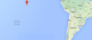
Strong earthquake jolts southeastern Pacific—USGS

The Pacific Tsunami Warning Center, based in Hawaii, said that the quake, which hit at 0214 GMT at 10 kilometers (6 miles) deep, registered as a 6.8 before upgrading it to a 7.2.
“An earthquake with a preliminary magnitude of 7.2 occurred near the southern East Pacific rise at 0215 UTC (GMT) Thursday, October 9 2014,” a statement from the Pacific center said.
“There is no tsunami threat from this earthquake,” it added.
The USGS said the tremblor registered as a 6.8.
Chile is one of the most seismically active countries in the world, and is located in the so-called Ring of Fire area of the Pacific Ocean basin.
Article continues after this advertisementAn 8.2-magnitude quake in northern Chile in April killed six people and forced a million to flee their homes in the region around Iquique.
Article continues after this advertisementAnd a February 27, 2010 quake that struck just off the coast of Chile’s Maule region measured 8.8 in magnitude, making it one of the largest ever recorded.
It killed more than 500 people and inflicted an estimated $30 billion in damages.
RELATED STORIES
Series of quakes strike off South Pacific islands – USGS
6.5 magnitude Pacific quake off Vanuatu, no tsunami warning