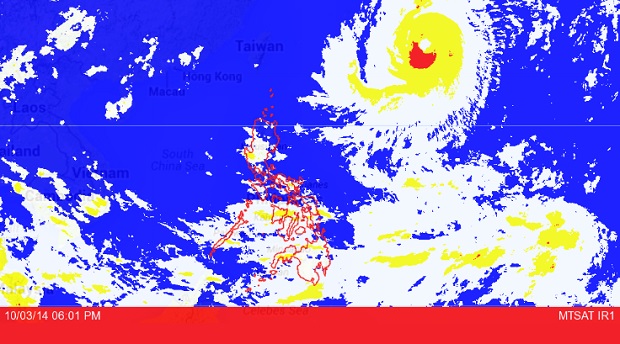
Project NOAH MTSAT image as of October 03, 2014, 6:01 PM. Screengrab from https://noah.dost.gov.ph/
MANILA, Philippines – Rains caused by a thunderstorm hit parts of Metro Manila in the late afternoon or evening of Friday.
“Thunderstorm is affecting Metro Manila (Quezon City and North Caloocan), and portions of Bulacan, Nueva Ecija, Tarlac, Rizal, Laguna and Quezon which may persist within two hours,” the Philippine Atmospheric Geophysical and Astronomical Services Administration said in an advisory at 4:54p.m.
Thunderstorm in Pampanga and other parts of Metro Manila are also forecast in the next two hours.
Typhoon Neneng, meanwhile, (Phanfone) was last located 1,330 kilometers east northeast of Itbayat in Batanes, Pagasa said.
It packed maximum sustained winds of 175 kilometers per hour near the center and gusts of up to 210 kph.
It is seen moving northwest at 20 kph.
“Western Visayas, Zamboanga Peninsula, and the province of Palawan will have cloudy skies with light to moderate rainshowers and thunderstorms. Metro Manila and the rest of the country will be partly cloudy to cloudy with isolated rainshowers or thunderstorms,” Pagasa said.