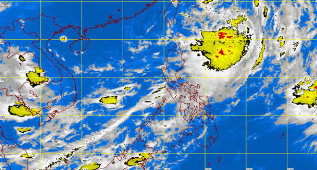
‘Inday’ intensifies into tropical storm
MANILA, Philippines—Set on course to leave the Philippine Area of Responsibility on Thursday evening, “Inday” has intensified into a Tropical Storm from a Tropical Depression Thursday morning, the weather bureau said.
In its weather bulletin, the Philippine Atmospheric, Geophysical and Astronomical Services Administration (Pagasa) said that “Inday” packs maximum sustained winds of 75 kilometers per hour and gusts of 90 kph.
Pagasa added that “Inday” was last spotted at 580 km northeast of Basco, Batanes at 4 a.m. Thursday going north northwest at a pace of 17 kph.
Metro Manila, Calabarzon, Central Luzon, Bicol, Cagayan Valley and Western Visayas would experience occasional rains while Mimaropa would have cloudy skies with light to moderate rainshowers and thunderstorms.
Other parts of the country would be partly cloudy to cloudy with isolated rainshowers and thunderstorms.
Article continues after this advertisementRELATED STORIES
Article continues after this advertisement‘Inday’ slows down, maintains strength
‘Inday’ maintains strength, Mimaropa to experience rains
