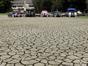
El Niño to hit in last quarter
MANILA, Philippines–The El Niño that is expected to be felt throughout most of the country during the last three months of the year will be “weak to moderate,” according to the weather bureau.
In its seasonal climate outlook for the second half of the year, the Philippine Atmospheric Geophysical Astronomical Services Administration (Pagasa) has warned of generally below normal rainfall in many parts of Luzon and the Visayas from October to November.
Worse in December
The El Niño episode is expected to worsen in December, when way-below to below-normal rainfall is expected to be felt in the entire country, except for Leyte, Northeast Mindanao and Sarangani province.
Since May, Pagasa has warned that an El Niño episode will likely develop during the latter part of the year until early 2015 because of the increasingly above-average sea surface temperatures and significant weakening of the low-level trade winds across the central and eastern equatorial Pacific.
A weak to moderate El Niño condition may fully develop during October to December, Pagasa said.
“For the month of October and November, generally below normal rainfall conditions are likely in most areas of Luzon and the Visayas,” it said.
“Near normal rainfall conditions will be expected over Cagayan, Camarines Norte, Albay, Eastern and Central Visayas and most areas of Mindanao,” it said.
Below normal rainfall
And in December, way-below to below-normal will probably prevail over the country, except for Leyte, Northeastern Mindanao and Sarangani which may experience near normal rainfall conditions, it said.
But before El Niño sets in, the country will experience the peak of the southwest monsoon (or the habagat) and the peak of tropical cyclone activity from July to September, marked by heavy rainfall and strong wines, the weather bureau said.
Eight to 10 tropical cyclones are likely to enter the Philippine area of responsibility (PAR) during those months, according to Pagasa.
It said that during the months of July and August, rainfall is expected to be near to above normal in most parts of the country.
However, patches of below-normal rainfall is expected over Ilocos Norte, La Union, Camarines Norte, Cebu, Biliran, Leyte, the Zamboanga Peninsula, Surigao del Norte, Basilan and Sulu.
Gradual recession
Pagasa said the gradual recession of the southwest monsoon rains can expected during the latter part of September up to early October.
“Concerned agencies are advised to take precautionary measures to mitigate the potential adverse impacts of El Niño,” said Pagasa acting administrator Vicente Malano.
The El Niño is the weather phenomenon brought on by the unusual warming of ocean surface temperatures in the central and eastern equatorial Pacific.
This can result in generally reduced rainfall but also in the erratic behavior of tropical cyclones, Pagasa said.
The tropical cyclone tracks are expected to shift northward and their intensity could become stronger, it said.
RELATED STORY
