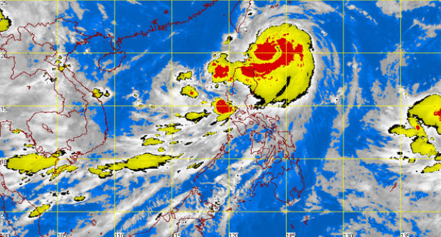
MANILA, Philippines–Typhoon “Henry” was last spotted traversing Balintang Channel toward the eastern coast of Batanes, the weather bureau said early Tuesday morning.
In its 5 a.m. weather bulletin, the Philippine Atmospheric, Geophysical and Astronomical Services Administration (Pagasa) said Typhoon “Henry” was located at 280 kilometers east of Aparri, Cagayan, or 240 km southeast of Basco, Batanes.
“Henry” has maintained its maximum sustained winds of 130 kilometers per hour and gusts of up to 160 kph while moving northwest path at a pace of 24 kph.
Signal No. 2 remains hoisted over the Batanes Group of Islands while signal No. 1 is still up in Cagayan, Babuyan Group of Islands, and Calayan Group of Islands.
Due to the typhoon, Ilocos Region, Cordillera Administrative Region, and Cagayan Valley will experience moderate to occasional heavy rains while the rest of Luzon and Western Visayas will experience monsoon rains, Pagasa said. Residents in these areas have been advised to be alert against possible flashfloods and landslides.
