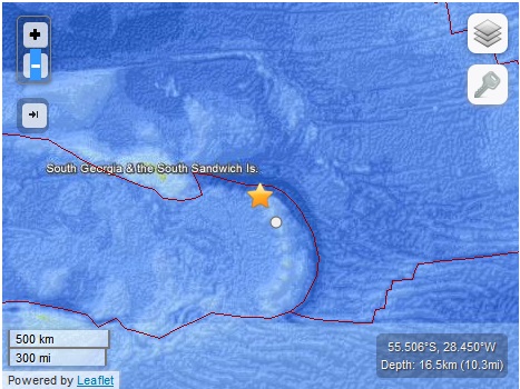
WASHINGTON–A powerful 6.9 magnitude earthquake struck in the far south Atlantic ocean in the inhospitable South Sandwich Islands region, the US Geological Survey said Sunday.
The USGS which monitors quakes worldwide initially said the quake was of magnitude 7.1, but later revised its strength downward. It also slightly revised the epicenter’s location.
The quake, which struck at 0752 GMT, had an epicenter 154 kilometers (96 miles) northwest of the uninhabited Visokoi Island, and 1,975 kilometers (1227 miles) east-southeast of Stanley, the main city on the Falkland Islands, the USGS reported.
The epicenter was at a depth of 16.5 kilometers.
The Hawaii-based Pacific Tsunami Warning Center issued a bulletin stating that, based on historical data, “a destructive widespread tsunami threat does not exist.”
The quake occurred near the boundary between the Antarctic tectonic plate and the Scotia Sea plate, two plates that slide past one another horizontally.
Earthquakes in the Pacific Rim area are more likely to trigger tsunamis because they are usually subduction quakes, when one tectonic plate moves under another and triggers a vertical movement in the seafloor.
The South Georgia and the South Sandwich Islands is a British overseas territory. There is no native population to the islands, but there are scientific research outposts. Argentina claims the archipelago as well as the Falkland Islands to the west.
RELATED STORIES
6.7 quake in south Atlantic near S.Sandwich Islands
Strong quake hits Atlantic near Sandwich Islands –USGS
