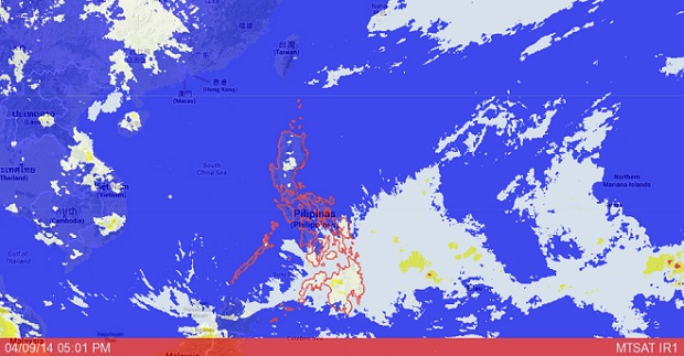
MANILA, Philippines — Tropical depression “Domeng” is expected to make landfall in the Samar provinces on Saturday, the state weather bureau said.
Jun Galang of the Philippine Atmospheric Geophysical and Astronomical Services Administration said Domeng was moving slowly because of a high pressure area, known as anti-cyclone. It causes warm weather and at the same time slows down bad weather.
If Domeng does not dissipate, it will be out of the Philippine area of responsibility by Monday, Galang said. He also did not discount the possibility that it will re-intensify into a storm.
The tropical depression was last forecast 370 kilometers east of Hinatuan, Surigao Del Sur with maximum winds of 45 kph near the center.
It is forecast to move northwest at 5 kph.
Central and Eastern Visayas and the regions of Caraga and Davao will have cloudy skies with light to moderate rainshowers and thunderstorms, Pagasa said.
Metro Manila and the rest of the country will be partly cloudy to cloudy with isolated rainshowers or thunderstorms mostly in the afternoon or evening.
Moderate to strong winds blowing from the northeast to northwest will prevail over the eastern section of the country and its coastal waters will be moderate to rough. Elsewhere, winds will be light to moderate coming from the northeast to northwest with slight to moderate seas.
RELATED STORIES
