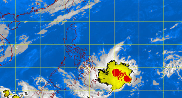
MANILA, Philippines—Light rains and isolated thunderstorms are forecast in Mindanao and Eastern Visayas on Tuesday even as “Domeng” has weakened into a tropical depression.
Domeng was last spotted 620 kilometers east of Davao City, with maximum sustained winds of 55 kilometers per hour near the center, the Philippine Atmospheric Geophysical and Astronomical Services Administration said.
The tropical cyclone continued to move slowly west northwest at 5 kph.
Metro Manila and the rest of the country will be partly cloudy to cloudy with isolated rainshowers or thunderstorms mostly in the afternoon or evening.
RELATED STORIES
100 areas in Visayas tipped to be hit by storm surge due to ‘Domeng’
MOST READ
LATEST STORIES
