13 areas now under Signal No.2
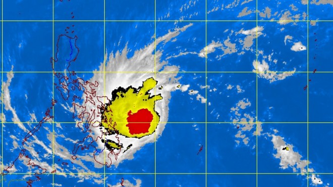
MANILA, Philippines – Signal No. 2 was raised in parts of Visayas and Mindanao as “Basyang” intensified into a tropical storm midday Friday.
Basyang continued to move towards Leyte-Caraga area and storm signals were raised in the following areas, according to the Philippine Atmospheric Geophysical and Astronomical Services Administration:
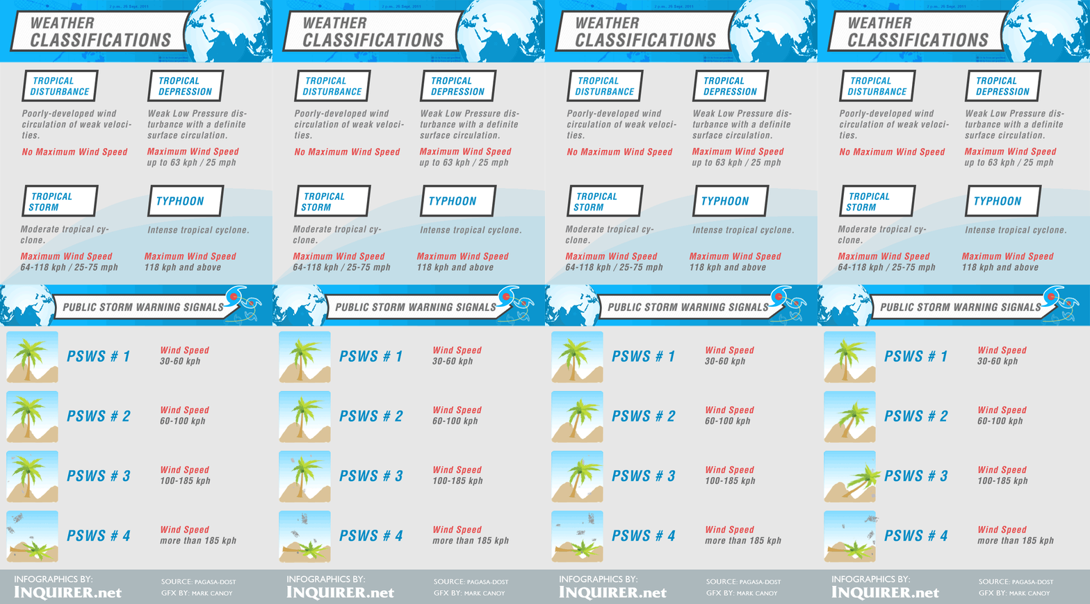
Signal No. 2 (winds with 60 to 100 kph):
Cebu
Bohol
Leyte
Southern Leyte
Eastern Samar
Samar
Camotes Island
Camiguin
Dinagat Province
Surigao del Norte
Siargao Is.
Northern Part of Surigao del Sur
Northern Part of Agusan del Norte
Signal No. 1 (winds with 3-60kph):
Masbate
Cuyo Island
Northern Samar
Biliran Is.
Aklan
Capiz
Antique
Iloilo
Guimaras
Negros Occidental
Negros Oriental
Siquijor
Misamis Oriental
Misamis Occidental
rest of Agusan del Norte
rest of Surigao del Sur
Agusan del Sur
Northern part of Bukidnon
Zamboanga del Norte
Basyang was expected to make landfall over Southern Leyte- tip of Surigao late Friday or early Saturday.
Article continues after this advertisementResidents living in low-lying and mountainous areas under storm signals were warned by Pagasa of possible flashfloods and landslides. Those living in areas under Signal No. 2 were warned of storm surges.
Moderate to heavy rains were forecast within the 400 kilometer-diameter of Basyang.
Fishing boats and other small seacraft were also advised not to venture out into the eastern seaboard of Central and Southern Luzon due to the surge of northeast monsoon.
Basyang was last spotted 500 kilometers east northeast of Hinatuan in Surigao del Sur, packing maximum sustained winds of 65 kilometers per hour near the center and gusts of up to 80 kph.
It was forecast to move west at 30 kph and will exit the Philippine area of responsibility by Monday morning.
RELATED STORIES
LPA intensifies into tropical depression, may enter PAR Thursday

