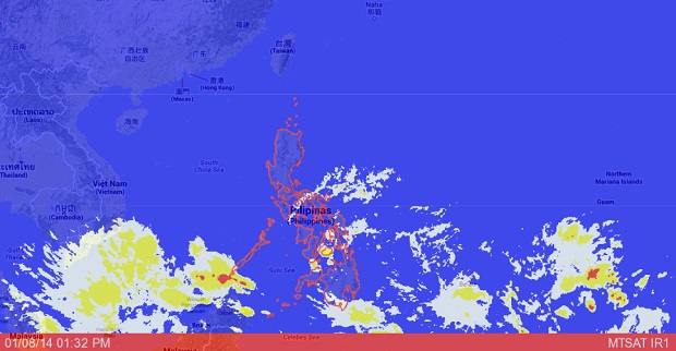
MANILA, Philippines–A low pressure area, which has “medium” chances of intensifying into a tropical depression, is forecast to enter the Philippine area of responsibility on Friday.
“The LPA is seen to enter PAR on Friday at the eastern border,” Joey Figuracion, weather forecaster of the Philippine Atmospheric Geophysical Astronomical Services Administration told INQUIRER.net.
The potential cyclone is currently located 1,500 kilometers away from PAR, or over the Pacific Ocean.
Figuracion said it could enter the eastern part of either Visayas or Mindanao. When it enters PAR, it will be located 900 kilometers east of Mindanao.
There is also a possibility that it will go upwards when the LPA enters PAR.
Should it intensify into a tropical depression, it will be called “Agaton,” the first cyclone in the Philippines this year.
Figuracion said they have not seen indications that the LPA will strengthen into a typhoon.
A trough or extension of the LPA is affecting Mindanao, which will bring rains there, Pagasa said in its daily forecast.
“Eastern Visayas, Caraga and Northern Mindanao will experience cloudy skies with light to moderate rainshowers and thunderstorms,” Pagasa said.
The northeast monsoon or hanging amihan continues to affect Luzon.
“Metro Manila and the rest of Luzon will have partly cloudy to cloudy skies with isolated light rains. The rest of the country will be partly cloudy to cloudy with isolated rainshowers or thunderstorms,” Pagasa said.


