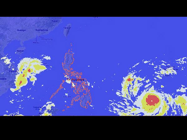
MT Satellite image November 6, 2013, 6:00 AM. Screengrab from Project NOAH Mahar Lagmay twitter account @nababaha
MANILA, Philippines—Supertyphoon “Haiyan” continued to move westward and inch closer to the Philippines, the state weather bureau said Wednesday morning.
Traveling at a faster speed of 30 kph (from the previous 20 kph), the typhoon, according to the Philippine Atmospheric Geophysical and Astronomical Services Administration (Pagasa), is expected to arrive as early as Wednesday midnight. It is forecast to make landfall in eastern Visayas on Friday. It would affect the Visayas and parts of Luzon and Mindanao.
The typhoon was last observed 1,560 kilometers east of Mindanao, packing maximum sustained winds of 120 kilometers per hour and gusts of up to 150 kph, Pagasa said.
The typhoon will be locally named “Yolanda” when it enters the Philippine area of responsibility.
The US-based weather website Accuweather.com said Haiyan remains a threat to the Philippines.
“Widespread torrential rain and damaging winds will accompany Haiyan through the central Philippines, threatening to leave a trail of destruction and triggering life-threatening flash floods,” Accuweather said.
“Rain totals along the path of Haiyan could top 200 mm (8 inches). Mudslides are a serious concern in the higher terrain, where localized totals of 250 to 300 mm (10 to 12 inches) are not out of the question,” it added.
The northeast monsoon, meanwhile, continues to affect northern and Central Luzon.
“The whole country will experience partly cloudy to cloudy skies with light rains over the regions of Cagayan Valley, Cordillera, Ilocos and Central Luzon while Metro Manila and the rest of the country will have isolated rainshowers or thunderstorms mostly over the eastern section,” Pagasa’s morning bulletin said.
Moderate to strong winds blowing from the northeast will prevail over Luzon and western Visayas and the coastal waters along these areas will be moderate to rough. Elsewhere, winds will be light to moderate coming from the northeast to north with slight to moderate seas.