‘Vinta’ enters PH, may affect Metro Manila–Pagasa
MANILA, Philippines — Tropical depression Vinta entered the Philippine area of responsibility on Tuesday morning, the state weather bureau said.
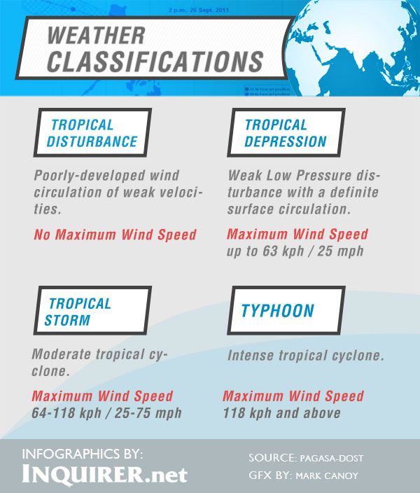
Vinta was last observed 1,150 kilometers east of Virac, Catanduanes, packing maximum sustained winds of 45 kilometers per hour, the Philippine Atmospheric Geophysical and Astronomical Services Administration said.
It is moving west-northwest at 24 kph.
Alvin Pura of Pagasa said that Vinta might make landfall on Thursday in Northern or Central Luzon. Should it make landfall in Central Luzon, it will affect Metro Manila.
Vinta is expected to exit by Friday.
Article continues after this advertisementIt also may further intensify but will not yet affect any part of the country as of posting time.
Article continues after this advertisementMetro Manila and the regions of Ilocos, Cordillera, Cagayan Valley and Central Luzon will experience partly cloudy to cloudy skies with isolated light rains, Pagasa said.
The rest of the country will be partly cloudy to cloudy with isolated rainshowers or thunderstorms mostly in the afternoon or evening.
Moderate to occasionally strong winds blowing from the northeast will prevail over Northern and Eastern Luzon and the coastal waters along these areas will be moderate to occasionally rough. Elsewhere, winds will be light to moderate coming from the northeast to northwest with slight to moderate seas.

