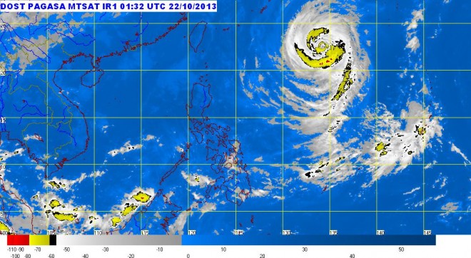
‘Urduja’ will not whip PH but sea travel risky off parts of Luzon — Pagasa
MANILA, Philippines — Typhoon “Urduja” entered the Philippine area of responsibility early Tuesday but state weather forecasters predicted it would not affect any part of the country.
At midday-Tuesday, the typhoon (international name Francisco) was spotted some 1,130 kilometers east-northeast of Itbayat, Batanes, the Philippine Atmospheric, Geophysical and Astronomical Services Administration (Pagasa) said.
Urduja was packing winds of 160 kilometers per hour (kph) near the center and gustiness of up to 195 kph. It was forecast to move northwest at 13 kph.
The typhoon had a diameter of 900 kilometers, as of Tuesday, within which it would likely dump heavy to intense rains at 10-25 millimeters per hour, Pagasa said.
Even though the threat from Urduja was seen as low as of Tuesday, sea travel would be risky in the seaboards of Northern Luzon and the eastern seaboards of Central and Southern Luzon, the weather bureau said.
Article continues after this advertisementBased on Pagasa’s 24-hour weather outlook, Mindanao will experience cloudy skies with scattered light to moderate rain showers and thunderstorms.
Article continues after this advertisementMetro Manila and the regions of Ilocos, Cordillera, Cagayan Valley, Central Luzon and Bicol Region would be partly cloudy to cloudy with isolated light rains, it said.
The rest of Luzon and Visayas will have partly cloudy to cloudy skies with isolated rain showers or thunderstorms, according to Pagasa.
Moderate to strong winds blowing from the northeast will prevail over Luzon and its coastal waters will be moderate to rough. Elsewhere,
winds would be light to moderate coming from the northeast to northwest with slight to moderate seas, Pagasa added.
Related stories
‘Urduja’ enters but won’t affect PH—Pagasa
