‘Santi’ intensifies, hovers over Catanduanes—Pagasa

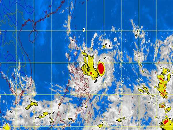
MT Satellite image October 10, 2013, Thursday, 8:32 AM. Screengrab from https://www.pagasa.dost.gov.ph/
MANILA, Philippines—Tropical storm “Santi” (international codename: Nari) intensified anew early Thursday, the state weather bureau said.
The storm packed maximum sustained winds of 75 kilometers per hour near the center and gusts of up to 90 kph, the Philippine Atmospheric Geophysical and Astronomical Services Administration said.
It is forecast to move west northwest at 11 kph.
Santi was last observed 400 kilometers east of Virac, Catanduanes, Pagasa said.
Moderate to intense rains were seen within the 300 kilometer-diameter of the storm.
Article continues after this advertisementBy Friday morning, Santi is forecast at 190 kilometers northeast of Virac. By Saturday morning, it is forecast 140 kilometers east of Baler, Aurora and in the vicinity of Pangasinan by Sunday morning.
Article continues after this advertisement“Catanduanes will have rains with gusty winds with moderate to rough seas. The rest of Bicol region will experience cloudy skies with moderate to occasionally heavy rainshowers and thunderstorms which may trigger flashfloods and landslides,” Pagasa said.
Metro Manila, Mimaropa, Calabarzon, Visayas and Mindanao will be cloudy with light to moderate rainshowers and thunderstorms. The rest of the country will have partly cloudy to cloudy with isolated rainshowers or thunderstorms.