‘Ramil’ spares PH but rain seen in spots
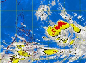
MANILA, Philippines—While Typhoon “Ramil” (international name: “Danas”) breezed past the country toward the southern islands of Japan with hardly any effect, the weather bureau expects the intertropical convergence zone (ITCZ) to continue to bring rain over portions of the Visayas and Mindanao.
The Philippine Atmospheric, Geophysical and Astronomical Services Administration (Pagasa) predicts that generally good weather will prevail Tuesday over Luzon, including Metro Manila, and some parts of the Visayas, although light to moderate rains are expected in the afternoon or evening.
Forecaster Samuel Duran said that before noon on Monday a much stronger and faster Ramil exited the Philippine area of responsibility (PAR).
The typhoon had maximum winds of 175 kilometers per hour near the center and gusts of up to 210 kph. It was moving northwest toward the southern Japanese islands at a speed of 28 kph.
He said that while the typhoon did not directly affect the country, the ITCZ was expected to continue bringing rain to Western Visayas and Mindanao. The ITCZ results from the convergence of trade winds from the northern and southern hemispheres.
Article continues after this advertisement“Metro Manila and other parts of the country will have generally good weather,” Duran said.
He said Pagasa was monitoring a low pressure area way outside the PAR. “It is somewhere far east of the country,” Duran told the Inquirer.—Jeannette I. Andrade
