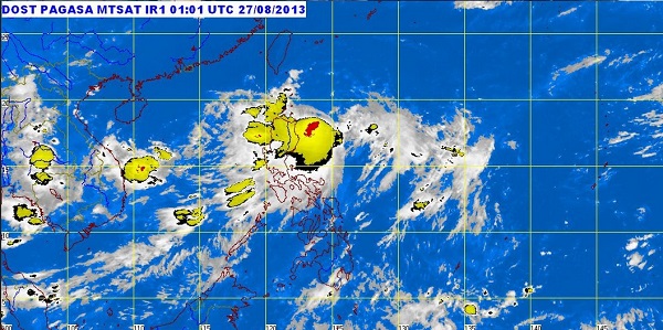
MANILA, Philippines — Only Batanes Group of Islands remained under a public storm warning signal as tropical storm “Nando” (international name Kong-Rey) continued to move northward, the state weather bureau said Wednesday afternoon.
Batanes Group of Islands was placed under Signal No. 1 while storm signals in other areas were already lifted, the Philippine Atmospheric Geophysical and Astronomical Services Administration said.
The storm was last observed 180 kilometers north northeast of Basco in Batanes, packing maximum sustained winds of 95 kilometers per hour and gusts of up to 120 kph.
It was moving north at 15 kph, and is expected to exit by Thursday afternoon.
Heavy to intense rains were seen within the 500 kilometer-diameter of the tropical storm.
Residents under the storm signal as well as those in Ilocos and Cordillera were alerted against possible flashfloods and landslides.
The storm will continue to enhance the southwest monsoon which will bring light to moderate rains and thunderstorms over Metro Manila and the western section of Central and Southern Luzon.
Sea travel is still risky over the seaboards of Northern Luzon, Pagasa said.
Related stories:
Tropical storm ‘Nando’ continues to move away from PH; to exit PAR Thursday
Tropical storm ‘Nando’ claims 1 fatality in Samar
