New storm brewing east of northern Luzon
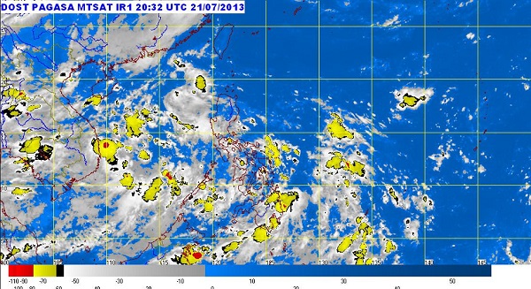
MANILA, Philippines—A new weather disturbance is brewing over the Pacific Ocean, threatening to enter the country’s territory on what appears to be the same track taken by Tropical Storm Maring, forecasters said Thursday.
The low-pressure area was spotted mid-Thursday east of Northern Luzon, some 550 kilometers from the edge of the Philippine area of responsibility, the Philippine Atmospheric, Geophysical and Astronomical Services Administration (Pagasa) said.
But the LPA was still too far to have any effect on the weather, said Rene Paciente, chief of Pagasa’s weather forecasting section.
He added that if the new low pressure area actually enters the Philippines, it would likely pass quickly as it was almost parallel to the northern tip of Luzon.
The southwest monsoon continued to prevail Thursday over the western sections of Luzon, spawning light to moderate rains over Metro Manila and surrounding areas. Moderate to heavy rains persisted over the western sections of Northern and Central Luzon, Pagasa said.
Article continues after this advertisementAccording to Pagasa’s 24-hour weather outlook, Metro Manila, Central Luzon, Ilocos and Cordillera will experience monsoon rains that could trigger flash floods and landslides.
Article continues after this advertisementCagayan Valley, Calabarzon (Cavite, Laguna, Batangas, Rizal and Quezon), the provinces of Mindoro, Marinduque, Romblon and the island of Mindanao will have cloudy skies with light to moderate rain showers and thunderstorms.
Palawan, Bicol region and Visayas will be partly cloudy to cloudy with isolated rain showers or thunderstorms, it said.
Moderate to strong winds blowing from the south to southwest will prevail throughout the archipelago and the coastal waters will be moderate to rough, Pagasa said.
