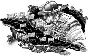
Having both proper risk management and political will would indubitably save lives and property.
Time and again, we’ve emphasized the importance of the paradigm shift in disaster management introduced by Republic Act 10121 or the Disaster Risk Reduction Management Act of 2010. This is necessary as our planet experiences the effects of climate change.
The July 20 flashflood in low-lying parts of Cebu City like Mabolo, including areas not known to be flood-prone, was yet another wake up call as we expect wacky weather patterns and stronger storms.
City Hall responded with Mayor Michael Rama forming a team to check vulnerable areas as part of the the project Reduction of Danger Zones (Redz). Another round of heavy downpours last weekend increased landslide risks in at least three barangays – Toong and Buhisan in the mountains, and hinterlands of Quiot.
Heightened attention is needed in case of an emergency. This time, communities are talking about putting up early warning systems.
At the 100-year-old Buhisan Dam, families living along and beside the man-made spillway know they chose risky locations for their homes.
Like the dilemma posed by communities straddling the banks of rivers and creeks, the city government has to reckon with the cost of relocating 2,000 shanties on the dam’s spillway.
If not for concern raised by visiting City Hall officials over the high water level of the Buhisan Dam, which could be seen spilling over the crest, the existence of the spillway shanties would have remained just part of the scenery.
The presence of people living in the path of danger — and in illegal circumstances — has long been known. Just like the estimated 10,000 households living along creeks and esteros in Cebu City.
City Hall will have to do more than count affected residents or rescue flood victims. A wholescale effort is needed to move from vigilance to action in infrastructure, monitoring, relief operations and public awareness.
Cebu City has six rivers – Bulacao, Talamban, Kinalumsan, Guadalupe, Lahug and Mahiga. City engineers also count the Parian estero and Tagunol as major waterways.
Disaster managers should be able to assess how much water these channels can handle in the flow of runoff rainwater from the uplands to the city below when the skies dump above-normal rain.
Using science, Metro Manila was able determine why it went underwater when Ondoy struck. In his last State of the Nation Address, President Aquino said 3,600 cubic meters per second of water from the Sierra Madre flowed in Metro Manila’s waterways that has a capacity of only 1,000 cubic meters per second.
How much rampaging water can Cebu City’s rivers hold before it spills over to communities? How much rainfall can Cebu City’s watersheds hold before floodwaters rampage to the city? These can be calculated and used for models to explain to the public real scenarios of danger.
It’s way past time for the Cebu City government to get its act together, sideline political skirmishes, and carry out a 2006 Drainage Master Plan to change the course of a flood-prone city.