ITCZ weakens but Mindanao to remain wet | Inquirer News

ITCZ weakens but Mindanao to remain wet
/ 08:33 PM November 21, 2012

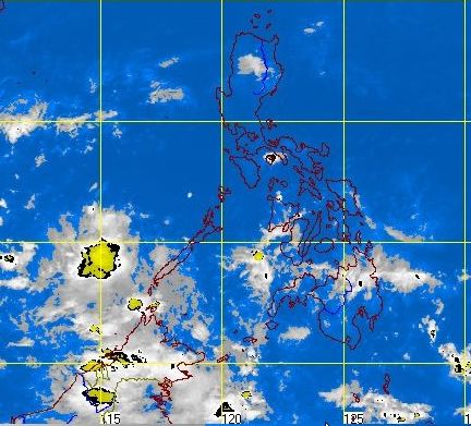
MANILA, Philippines — While the effect of the intertropical convergence zone (ITCZ) has weakened, the weather system is expected to keep Mindanao wet, according to the Philippine Atmospheric, Geophysical and Astronomical Services Administration (Pagasa).

In its 5 p.m. forecast, the weather bureau anticipated weather over Palawan, the Visayas and Mindanao to be cloudy with occasional light to moderate rainshowers or thunderstorms.

Cagayan Valley, the Aurora and Quezon Provinces are expected to have light rains brought by the amihan (northeast monsoon).

Article continues after this advertisement

Forecaster Gener Quitlong said that apart from the light rains, the amihan has been bringing in the cold temperature to Luzon.

FEATURED STORIES

He said the effect of the ITCZ over portions of the Visayas and Mindanao could last until February in 2013.

Generally good weather will continue to prevail over Metro Manila and the rest of Luzon, which is forecast to be partly cloudy with isolated brief rainshowers or thunderstorms mostly in the afternoon or evening.

Article continues after this advertisement

Moderate to strong winds blowing from the northeast to east will prevail over Luzon and the Eastern Visayas, where coastal waters will be moderate to rough.

Elsewhere, winds will be light to moderate coming from the northeast and east with slight moderate seas.

Your subscription could not be saved. Please try again.
Your subscription has been successful.

Subscribe to our daily newsletter

By providing an email address. I agree to the Terms of Use and acknowledge that I have read the Privacy Policy.

TAGS: News, Weather

Your subscription could not be saved. Please try again.
Your subscription has been successful.

Subscribe to our newsletter!

By providing an email address. I agree to the Terms of Use and acknowledge that I have read the Privacy Policy.

© Copyright 1997-2024 INQUIRER.net | All Rights Reserved

This is an information message

We use cookies to enhance your experience. By continuing, you agree to our use of cookies. Learn more here.