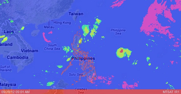
MANILA, Philippines — A new low pressure area is being monitored by the state weather bureau off Southern Luzon.
The potential cyclone was seen 1,120 kilometers east of Southern Luzon embedded along the intertropical convergence zone affecting Luzon and Visayas, the Philippine Atmospheric Geophysical and Astronomical Services Administration said.
An ITCZ is a merge of winds which becomes a breeding ground of potential cyclones.
Northern and Central Luzon, Calabarzon, Mimaropa and Western Visayas will have occasional light to moderate rains except during thunderstorms.
The rest of the country will have partly cloudy skies with brief rainshowers or thunderstorms mostly in the afternoon or evening.
Metro Manila will experience occasional light to moderate rains except during thunderstorms. Light to moderate winds blowing from the southwest to south will prevail and Manila Bay will be slight to moderate.
Moderate to strong winds blowing from the east will prevail over extreme Northern Luzon and the coastal waters along these areas will be moderate to rough.
Elsewhere, winds will be light to moderate coming from the southwest to southeast with slight to moderate seas.
