Rains back; tropical storm ‘Helen’ heading north
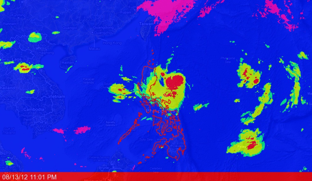
Tropical Storm “Helen” (international name: Kai-Tak) may further intensify into a typhoon as it continues to gain strength while moving toward the tip of northern Luzon, raising fears of more flooding in large swaths of the island.
The weather bureau on Monday raised Storm Signal No. 1 over Quirino, Aurora, Isabela, Kalinga, Apayao, Cagayan and Batanes.
The Philippine Atmospheric, Geophysical and Astronomical Services Administration (Pagasa) warned residents in low-lying and mountainous areas in the provinces to watch out for flash floods and landslides.
As of 4 p.m. Monday the center of Helen was spotted 430 kilometers east of Casiguran, Aurora province. It was packing maximum sustained winds of 65 kilometers per hour near the center and gustiness of up to 80 kph.
At a press briefing, Pagasa Administrator Nathaniel Servando said Helen was expected to enhance the “habagat” (southwest monsoon), which would bring moderate to heavy rains over Metro Manila, provinces in central and southern Luzon, as well as the Visayas.
Article continues after this advertisement“Even if rainfall over Metro Manila, Central Luzon and southern Luzon is estimated to be moderate to heavy there is the possibility of floods and landslides since the soil is still saturated (with water) by last week’s torrential rains,” Servando said.
Article continues after this advertisementSoil saturated
Science Secretary Mario Montejo said he did not expect the magnitude of the flooding to be similar to last week’s deluge in most areas of Metro Manila and nearby provinces, but he advised the public to be on alert for landslides.
“I am reiterating that the soil is already saturated in landslide-prone areas and based on our data, thunderstorms and intermittent rains are to be expected here,” Montejo said at the press briefing.
Helen is expected to dump 15 to 25 mm of rain per hour over the areas within its 400-km diameter cloud band.
Servando placed at 7.5 millimeters to 10 mm per hour, categorized as moderate to heavy, the volume of rain that would fall on Metro Manila, Camarines Norte, Camarines Sur, Quezon, Rizal, Bulacan, Pampanga, Laguna, Cavite, Batangas, Mindoro, Bataan and Zambales.
A millimeter of rainfall in a square meter is equivalent to 1 liter.
Servando said that while Helen was traveling almost the same path that Typhoon “Gener” took two weeks ago, the former was moving west-northwest at a faster pace of 13 kph.
“It is still over the ocean, so there is a big possibility that it would further intensify into a typhoon … But we do not see it developing into a super typhoon,” he said.
A tropical storm packs sustained winds of 65 to 118 kph. A weather system is classified a typhoon if sustained winds exceed 118 kph.
“If Helen does not change (in speed and direction), we expect the tropical storm to be out of the Philippine Area of Responsibility by Thursday,” Servando said.
Helen is expected to be 210 km east of Tuguegarao, Cagayan province, by Tuesday afternoon and 80 km south-southwest of Basco, Batanes province, by Wednesday morning. By Thursday afternoon, it is expected to be 310 km northwest of Basco, Batanes.
