Cloudy weather with chances of rain to prevail on Saturday (April 26)

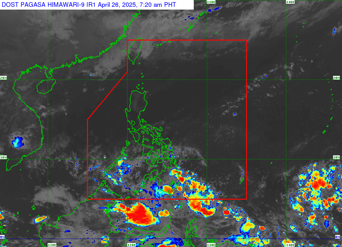
(Satellite image from Pagasa)
MANILA, Philippines — Parts of the country will experience cloudy weather with chances of rain due to the intertropical convergence zone (ITCZ) and the easterlies on Saturday, April 26.
This forecast comes from the Philippine Atmospheric, Geophysical and Astronomical Services Administration (Pagasa) in its morning weather forecast with specialist Grace Castañeda.
The agency said the entirety of Luzon, including Metro Manila, will experience warm and humid weather with partly cloudy to cloudy skies on Saturday.
“[M]ay posibilidad pa rin tayo ng mga isolated o mga biglaang pag-ulan, pagkidlat at pagkulog na dulot ng easterlies,” Castañeda said.
(We still have a possibility of isolated or sudden rain showers and thunderstorms due to the easterlies.)
The easterlies are warm winds from the Pacific Ocean.
Likewise, there is a chance of rains in the provinces of Eastern Samar and Southern Leyte due to the easterlies.
As for the rest of Visayas as well as the rest of Palawan, these areas will experience warm weather with partly cloudy to cloudy skies and a possibility of isolated or sudden rain showers also due to the easterlies.
Meanwhile, the entirety of Mindanao is projected to have cloudy skies and scattered rain showers due to the ITCZ.
The ITCZ is the zone wherein the winds from the northern and southern hemispheres converge.
READ: Pagasa buying new gear for heat index monitoring
“Itong mga pag-ulan na ito ay posibleng maging katamtaman at kung minsan ay malalakas na pag-ulan na maaaring magdulot ng mga pagbaha at pagguho ng lupa,” Castañeda noted.
(These rains may possibly be moderate and, at times, strong that may result in flooding or landslides.)
As for tropical cyclone monitoring, Pagasa is not seeing any new low pressure area around the archipelago.
READ: Pagasa: Zero to 1 tropical cyclone forecast in April
“Ngunit dahil active ngayon yung ITCZ dito sa bahagi ng Mindanao ay hindi natin inaalis yung possibility na sa mga susunod na araw ay posibleng may mabuong sirkulasyon o may mabuong low pressure area dito sa may silangan ng Mindanao,” Castañeda said.
(However, because the ITCZ is active now here in Mindanao, we are not discounting the possibility that in the next few days, a circulation or a low pressure area may be formed east of Mindanao.)
Meanwhile, light to moderate conditions are expected in the country’s waters and no gale warning has been raised.