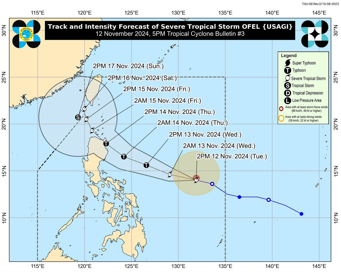
Track and intensity forecast of Severe Tropical Storm Ofel as of 5 p.m., Tuesday, November 12. (Photo by Pagasa/Facebook)
MANILA, Philippines — Tropical cyclone Ofel (international name: Usagi) intensified into a severe tropical storm on Tuesday afternoon and is forecast to steadily intensify within three days, the Philippine Atmospheric, Geophysical and Astronomical Services Administration (Pagasa) said.
In its 5 p.m. weather bulletin, Pagasa said that Ofel was last located some 780 kilometers east of Virac, Catanduanes, moving west-northwestward at 30 kilometers per hour (kph). It was now carrying a maximum wind speed of 95 kph and gustiness of up to 115 kph.
READ: Storm Ofel gains strength; Luzon landfall forecast on Nov. 14
Pagasa noted that as Ofel is likely to make landfall at peak intensity, and “hazards on land and coastal waters may still be experienced in areas outside the landfall point or forecast confidence cone,” regardless of the location of the landfall.
The weather bureau also said that Tropical Cyclone Wind Signal No. 1 may be hoisted over parts of Cagayan Valley late Tuesday evening or early Wednesday morning.
The following areas will experience strong to gale-force gusts brought by the wind flow coming towards the circulation of Ofel:
- Wednesday, November 13: Catanduanes
- Thursday, November 14: Quezon and the northern portions of Camarines Norte, Camarines Sur, and Catanduanes
- Friday, November 15: Eastern portion of Isabela and the northern portion of Aurora
Furthermore, Pagasa noted that a storm surge warning is up in the following areas:
- Cagayan
- Isabela
- Northern Aurora
Ofel, which entered the Philippine area of responsibility at 3 a.m. on Tuesday, may develop into a typhoon by Wednesday.
READ: Tropical Storm Ofel enters PAR, may reach typhoon status Nov 13