
(Track from Pagasa)
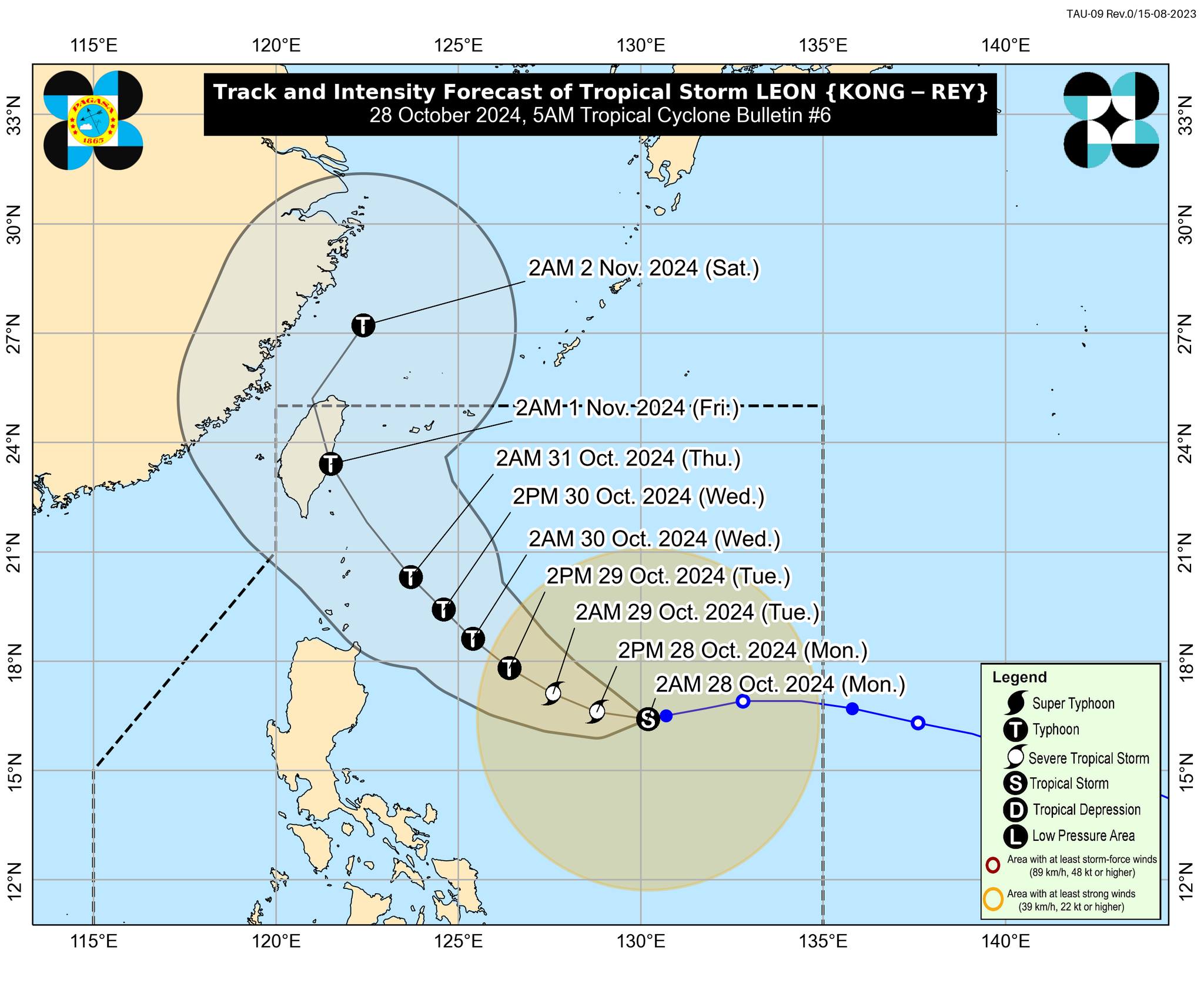
MANILA, Philippines — Tropical Storm Leon (international name: Kong-rey) maintained its strength as it slowed down over the Philippine Sea, according to the Philippine Atmospheric, Geophysical and Astronomical Services Administration (Pagasa).
In a 5 a.m. bulletin on Monday, the state weather bureau said Leon’s was last located some 40 kilometers east of Central Luzon.

It is now moving westward at 10 kilometers per hour, packing maximum sustained winds of 85 kph near its center and a gustiness of up to 105 kph.
Tropical Cyclone Wind Signal No. 1 is still raised in the following areas across Luzon:
- Eastern portion of mainland Cagayan (Santa Ana, Lal-Lo, Gattaran, Baggao, Santa Teresita, Gonzaga, Peñablanca)
- Eastern portion of Isabela (Maconacon, Divilacan, Ilagan City, San Pablo, Cabagan, Tumauini, Palanan, San Mariano, Dinapigue)
- The northeastern portion of Catanduanes (Pandan, Bagamanoc, Panganiban, Viga)
Winds of 39 to 61 kph and intermittent rains may be expected in these areas within 36 hours, according to Pagasa.
Based on the state weather bureau’s forecast track, Leon may pass closely over the Batanes area by Wednesday or Thursday.
“Sa araw ng Biyernes, maaaring mag-landfall ang gitna o center ng bagyong Leon sa Taiwan,” state weather specialist Aldczar Aurelio added.
(On Friday, Typhoon Leon’s center may make landfall in Taiwan.)
Aurelio further noted that the tropical storm may intensify as it remains over sea.
“Maaaring ngayong hapon ay lalakas ito at magiging severe tropical storm category,” he stated.
(It is likely to intensify this afternoon and reach the severe tropical storm category.)
READ: Leon slightly intensifies; Three areas placed under Signal No. 1