Leon slightly intensifies; Three areas placed under Signal No. 1
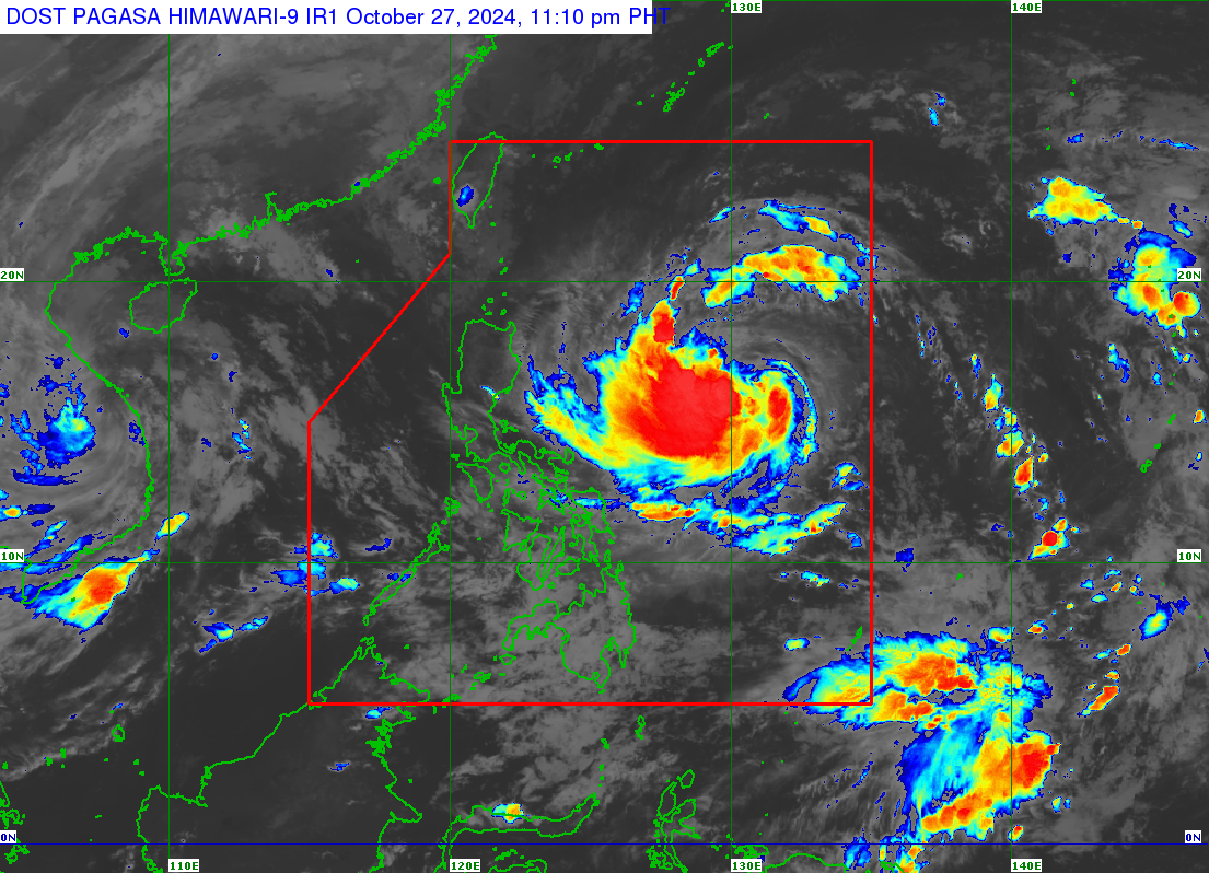
Satellite image from DOST/Pagasa
MANILA, Philippines — Tropical Storm Leon (international name: Kong-rey) has slightly intensified as it moved over the Philippine Sea, prompting the state weather bureau to raise Tropical Cyclone Wind Signal (TCWS) No. 1 in several areas across Luzon on Sunday evening.
In an 11 p.m. bulletin, the Philippine Atmospheric, Geophysical, and Astronomical Services Administration (Pagasa) reported that Leon was last spotted some 915 kilometers (km) east of Central Luzon.
READ: Leon may develop into severe tropical storm or typhoon
It is packing maximum sustained winds of 85 kilometers per hour (km/h) near the center, with gusts of up to 105 km/h.
Leon continues to move westward at 20 km/h, state meteorologists said.
“Depending on how close it will be during its north northwestward movement over the Philippine Sea, the outer rainbands of Leon may affect Extreme Northern Luzon,” Pagasa noted in a bulletin.
It added that the trough of Leon may also affect the areas of Visayas, Mindanao, and the western section of Southern Luzon.
The following areas in Luzon are placed under TCWS No. 1:
- Eastern portion of mainland Cagayan (Santa Ana, Lal-Lo, Gattaran, Baggao, Santa Teresita, Gonzaga, Peñablanca)
- Eastern portion of Isabela (Maconacon, Divilacan, Ilagan City, San Pablo, Cabagan, Tumauini, Palanan, San Mariano, Dinapigue)
- Northeastern portion of Catanduanes (Pandan, Bagamanoc, Panganiban, Viga)
Pagasa stated that minimal to minor impacts from strong winds are possible within any of the said areas.
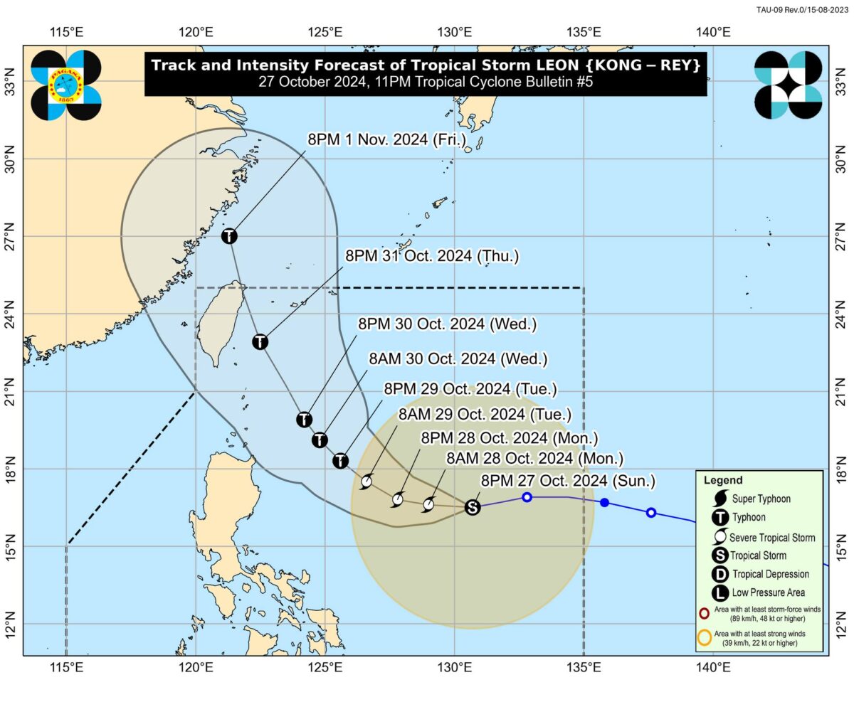
Tropical Storm Leon’s track and intensity forecast, as of 11 p.m. Sunday, October 27, 2024. —Courtesy of DOST/Pagasa
Based on the state weather bureau’s track forecast, Leon remains far from the Philippine landmass and may pass very close or make landfall over northern Taiwan.
“Leon is forecast to move westward for the next 24 hours before moving generally northwestward from tomorrow (28 October) evening until Wednesday (30 October), then north northwestward for the rest of the forecast period,” Pagasa further explained.
However, Pagasa has not ruled out the possibility of Leon intensifying into a severe tropical storm on Monday and potentially becoming a typhoon on Tuesday, as it may undergo rapid intensification.