
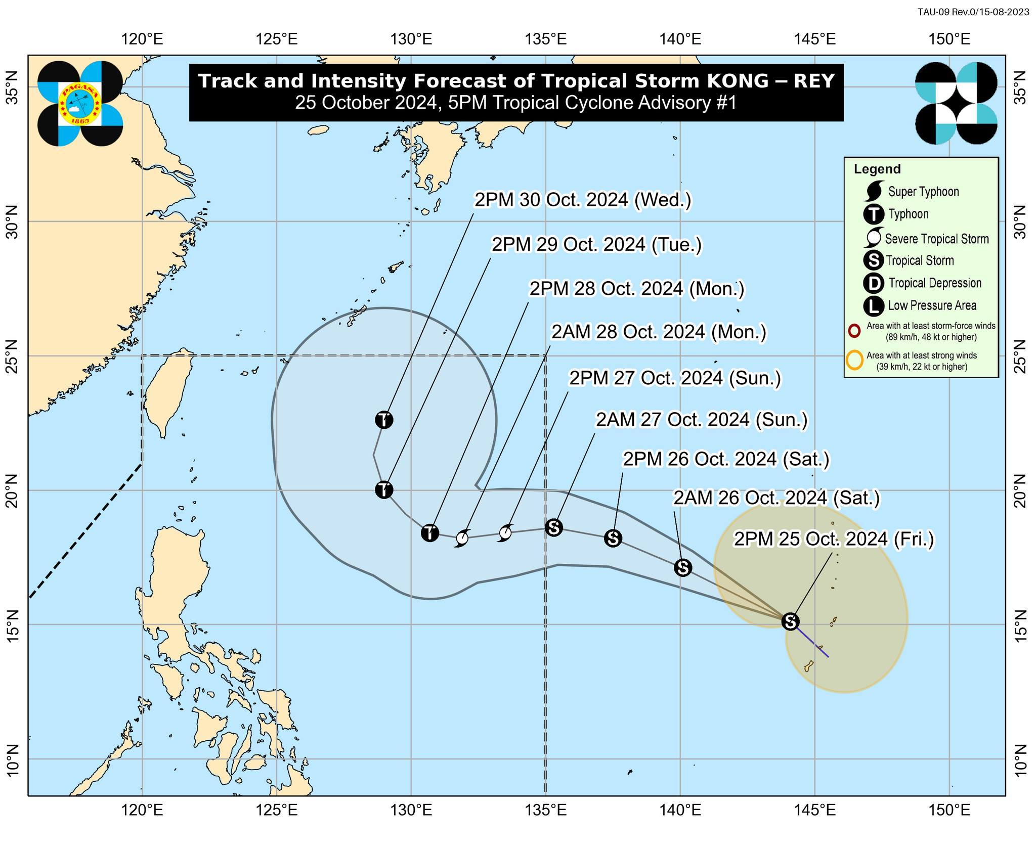
Track and intensity forecast for Tropical Storm Kong-rey issued at 5 p.m. on Friday, October 25 by the Philippine Atmospheric, Geophysical and Astronomical Services Administration (Pagasa). Image from DOST – Pagasa / Facebook page
MANILA, Philippines — Tropical Storm Kong-rey will enter the Philippine area of responsibility (PAR) and may intensify into a severe tropical storm with a domestic name of Leon on Sunday, the state weather bureau said.
In its 5 p.m. bulletin, the Philippine Atmospheric, Geophysical and Astronomical Services Administration (Pagasa) said that it may intensify into a typhoon on Monday. However, Kong-rey will remain far from landmass once it enters the PAR.
READ: LPA outside PAR may become tropical depression Friday – Pagasa
Moderate to rough sea conditions may be expected over the northern and eastern seaboards of Luzon and the eastern seaboard of Visayas.
Further, Kong-rey was last located some 2,355 kilometers east of Southern Luzon. It was moving northwestward at 35 kilometers per hour (kph) and packing up maximum wind speed of 65 kph and gustiness of up to 80 kph.
Pagasa added that the tropical storm “will move generally west northwestward then westward on Sunday (27 October) and Monday (28 October) while gradually decelerating.”
READ: Kristine accelerates, maintains strength outside PAR
Kong-rey developed into tropical storm status as of 4 p.m. on Friday. Meanwhile, Severe Tropical Storm Kristine has exited the PAR as of 2 p.m. on Friday.