Upon exit, Kristine may ‘loop’ over WPS and head back to PAR
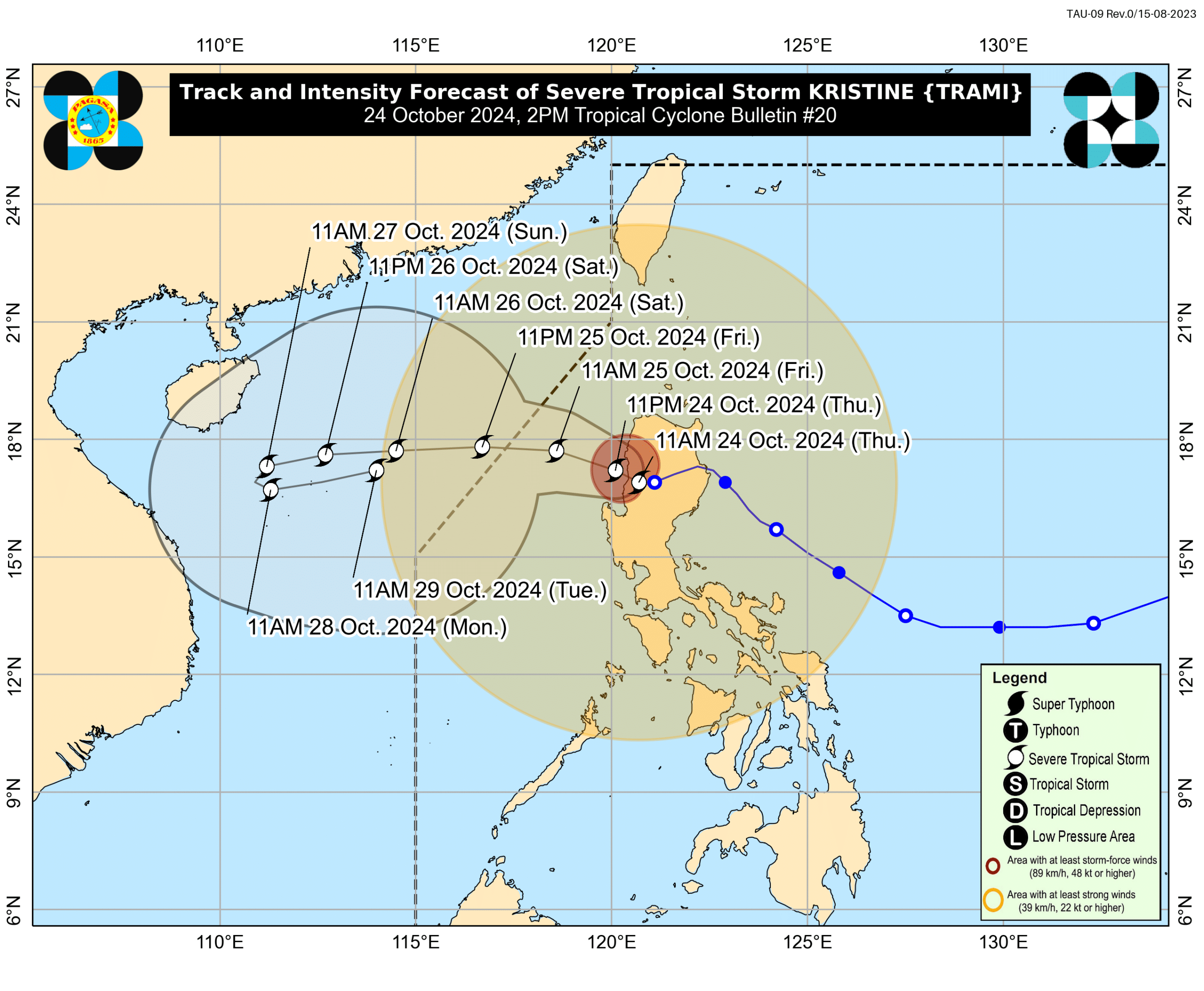
Track and Intensity Forecast of Severe Tropical Storm Kristine as of 2 p.m., October 24, 2024 (Image from DOST-Pagasa / Facebook)
MANILA, Philippines – Severe Tropical Storm Kristine (international name: Trami) may circle back to the direction of the country after exiting the Philippine area of responsibility (PAR) on Sunday, said the state weather bureau.
According to the Philippine Atmospheric, Geophysical and Astronomical Services Administration (Pagasa) in its 2 p.m. typhoon bulletin on Thursday, Kristine is expected to exit PAR by Friday afternoon.
READ: LIVE UPDATES: Tropical Storm Kristine
However, upon exiting PAR, Kristine may “loop” over the West Philippine Sea and then head toward the general direction of PAR on Sunday or Monday, depending on the influence of the low pressure area located east of Mindanao.
“In the extended outlook, there is a developing forecast situation wherein Kristine will be looping over the West Philippine Sea on Sunday and Monday and move eastward or east northwestward towards the general direction of the PAR region,” Pagasa said.
“However, this scenario heavily depends on the behavior of the weather disturbance east of the PAR region which is expected to develop into a tropical depression within the next 24 hours,” it added.
Furthermore, Kristine may also re-intensify as it coasts above the West Philippine Sea.
READ: LPA outside PAR may become tropical depression Friday – Pagasa
Currently, Kristine was last spotted over the coastal waters of Southern Ilocos Sur, carrying maximum sustained winds of 95 kilometers per hour (kph) and gustiness of up to 145 kph.
Meanwhile, the LPA spotted east of Mindanao is likely to intensify into a tropical depression by Friday or within the next 24 hours.