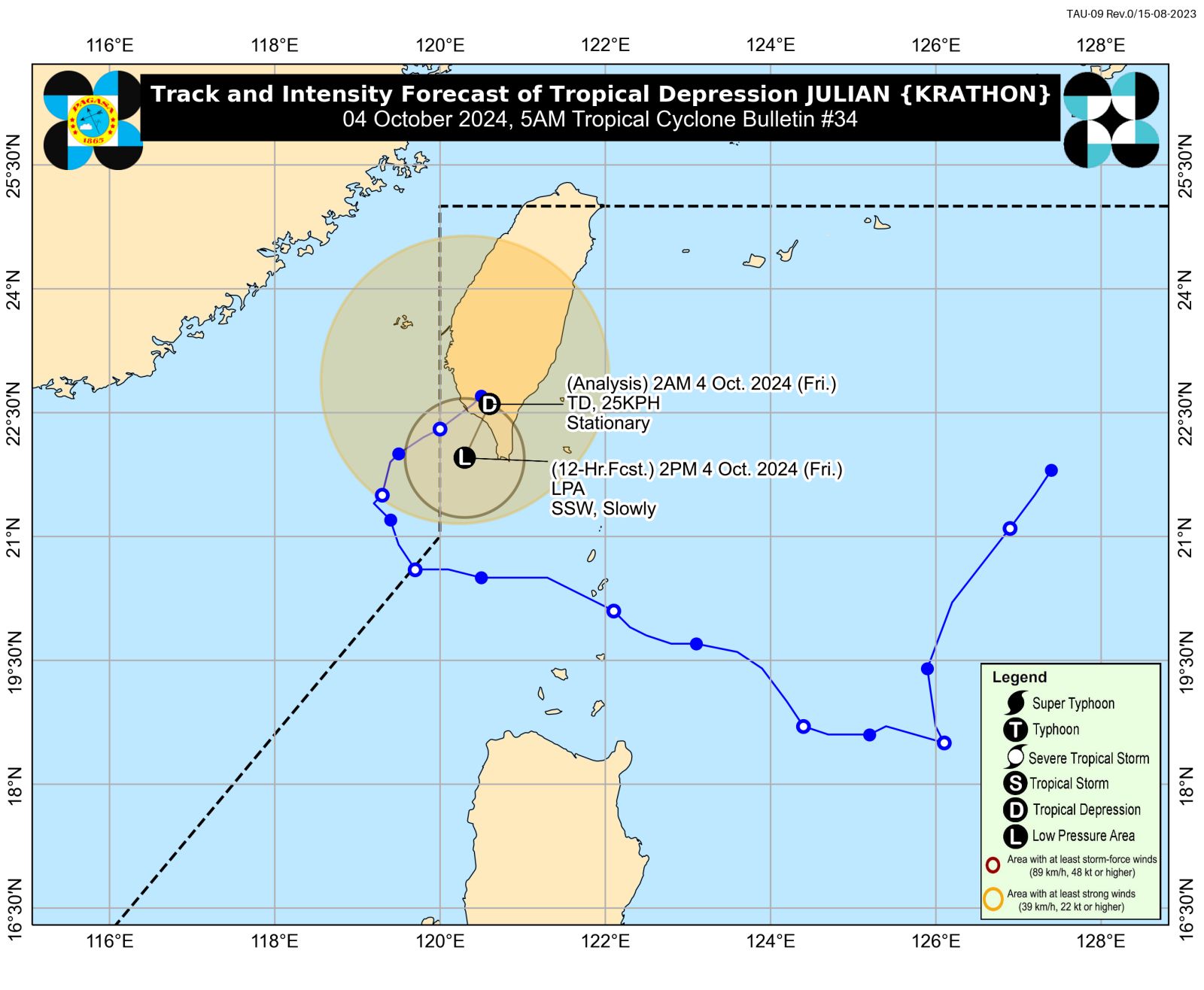
This image of the forecast track for typhoon Julian (international nem: Krathon) shows it is near Taiwan’s landmass but still inside the Philippine area of responsibility. – The strength of Julian decreased into a tropical depression as it lashed Taiwan before its expected landfall in the island. Photo from Pagasa
MANILA, Philippines — The strength of Julian decreased into a tropical depression as it lashed Taiwan, the Philippine Atmospheric, Geophysical and Astronomical Services Administration (Pagasa) said Friday.
The center of Julian (international nem: Krathon) was last located 240 km north-northwest of Itbayat, Batanes, packing maximum sustained winds of 45 kilometers per hour (kph) with gustiness of 75 kph, as of 5 a.m., according to the state weather agency.
“Julian is forecast to weaken into a remnant low today over the landmass of Taiwan or the sea southwest of Taiwan,” Pagasa said in an advisory early Friday morning.
READ: Taiwan shuts down for second day as Typhoon Krathon to land
Previously, Pagasa attributed the weakening of Julian to “a combination of incoming northeasterly wind flow over the East China Sea and Taiwan Strait and lower ocean heat content in its vicinity (which is related to upwelling of cooler waters caused by its slow movement for nearly two days).”
Batanes bore the brunt of Julian, tearing off roofs, uprooting trees, and knocking over electrical posts on the island.
READ: Julian weakens from super typhoon to typhoon on Wednesday morning
But while Julian no longer directly affects the country now, cloudy skies with scattered rains and thunderstorms are forecast in the Bicol Region, the entire Visayas, and the Zamboanga Peninsula on Friday.
Pagasa said this weather situation would be due to the intertropical convergence zone (ITCZ).
For the rest of the country, Pagasa said fair weather with partly cloudy to cloudy skies and isolated rain showers or thunderstorms may be expected Friday.