


(Track of typhoon Julian from DOST)
MANILA, Philippines — Typhoon Julian has re-entered the Philippine Area of Responsibility (PAR), the Philippine Atmospheric, Geophysical, and Astronomical Services Administration (Pagasa) said on Thursday.
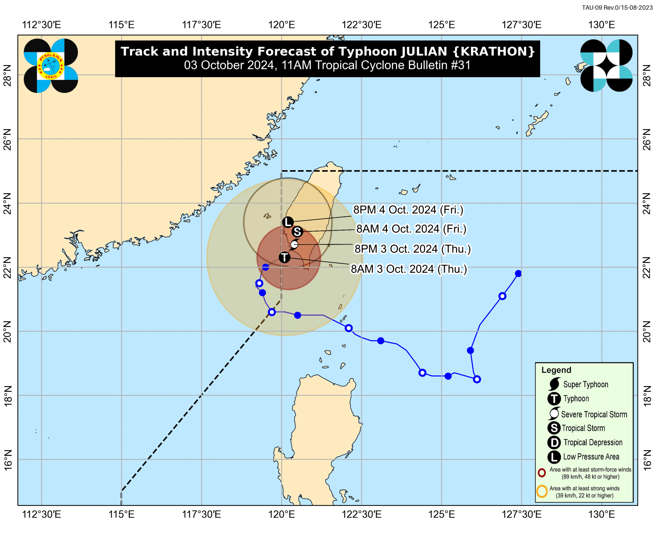
Pagasa said Julian entered PAR at 8 a.m. this Thursday and is now estimated at 245 kilometers (km) northwest of Itbayat, Batanes.
It is moving east northeastward, packing maximum sustained winds of 120 kilometers per hour (kph) with gusts of up to 165 kph, Pagasa added in its 11:00 a.m. cyclone bulletin.
“Despite its re-entry in the PAR region, no direct effect is anticipated over the country except for Batanes, which is relatively close to Taiwan,” state meteorologists said.
Batanes remains under Tropical Cyclone Wind Signal (TCWS) No. 1, where wind speeds of 39 to 61 kph may be expected.

“Pinapaalalahanan pa rin po natin ang mga kababayan po natin dito sa Batanes na possible pa rin po ang malalakas na hangin at mga pabugso-bugso na pag-ulan,” state weather specialist Chenel Dominguez said in a press briefing on Thursday.
(We are reminding our fellow citizens in Batanes that strong winds and occasional heavy rains are still possible.)
According to Pagasa, typhoon Julian is expected to make landfall over southwestern Taiwan on Thursday afternoon.
“After landfall, Julian is forecast to move erratically over Taiwan while rapidly weakening due to land interaction. This tropical cyclone is forecast to become a remnant low over Taiwan tomorrow (4 October),” the state weather bureau noted.
Julian may exit the PAR on Friday.
READ: Typhoon Julian to reenter PAR border before Taiwan landfall
“Possible din po na ito po ay mag dissipate or lumabas din po ng ating Philippine Area of Responsibility (PAR) by Friday,” Dominguez added.
Pagasa hoisted a gale warning over the northern seaboard of Northern Luzon.