Typhoon Julian to reenter PAR border before Taiwan landfall
Typhoon Julian (international name: Krathon) is forecast to reenter the northwestern boundary of the Philippine area of responsibility on Thursday, October 3, 2024, before making landfall in Taiwan, according to the Philippine Atmospheric, Geophysical and Astronomical Services Administration (Pagasa). Photo from Pagasa
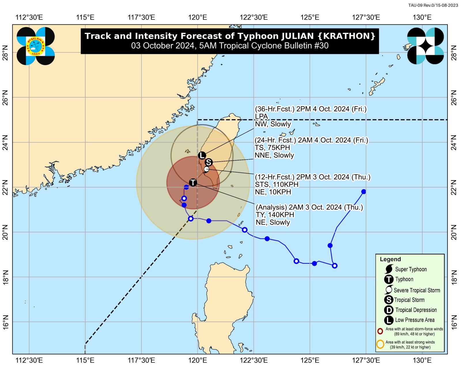
MANILA, Philippines — Typhoon Julian (international name: Krathon) is forecast to reenter the northwestern boundary of the Philippine area of responsibility on Thursday before making landfall in Taiwan, the state weather agency said.
Its return, however, would have no direct effect on the country except for Batanes, according to the Philippine Atmospheric, Geophysical and Astronomical Services Administration (Pagasa).
As of 4 a.m., Julian’s center was located 265 km west-northwest of Itbayat, Batanes, packing maximum sustained winds of 140 kilometers per hour (kph) and gustiness of 170 kph.
“Julian is forecast to make landfall over southwestern Taiwan this morning or afternoon after entering the northwestern boundary of the Philippine Area of Responsibility,” Pagasa said in its early Thursday morning typhoon bulletin.
READ: LIVE UPDATES: Typhoon Julian
“After landfall, Julian is forecast to move erratically over Taiwan while rapidly weakening due to land interaction.”
“Despite its re-entry in the PAR region, no direct effect is anticipated over the country except for Batanes, which is relatively close to Taiwan,” it also said.
Batanes is under Tropical Cyclone Wind Signal No. 1, where expected wind speeds of 39 to 61 kph may cause minimal to minor threat to life and property.
Julian is seen to weaken further and may become a remnant low — which refers to a former tropical cyclone that no longer has enough qualities to be considered such— by Friday, October 4.
From a super typhoon, Julian decelerated into the typhoon category on Wednesday.