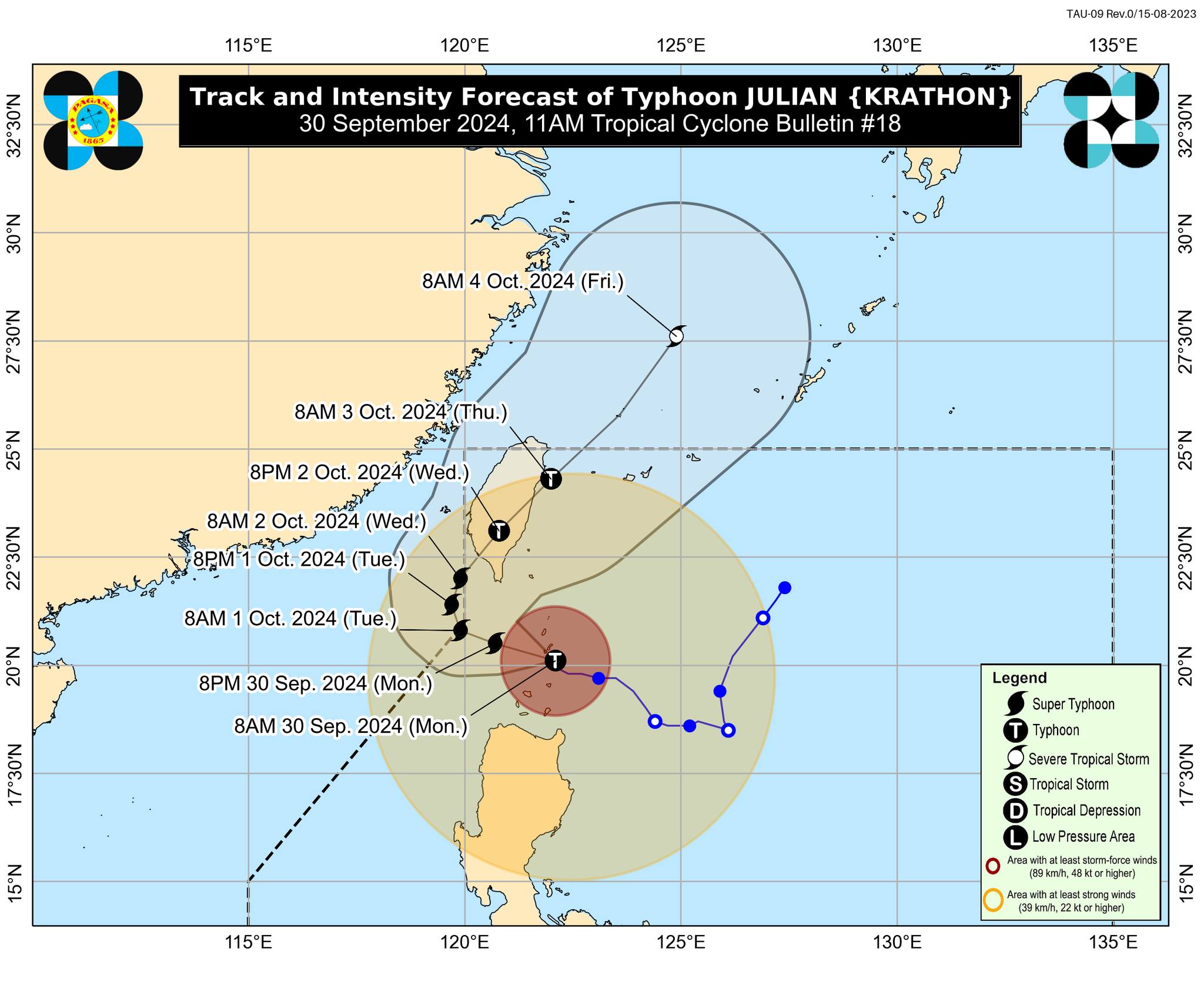
Typhoon Julian is approaching super typhoon strength and Philippine Atmospheric, Geophysical and Astronomical Services Administration (Pagasa) says Tropical Cyclone Wind Signal (TCWS) No. 5 may be raised over Northern Luzon on Monday, September 30, 2024. Image from DOST / Pagasa
MANILA, Philippines — Typhoon Julian is approaching super typhoon strength and the state weather agency said Tropical Cyclone Wind Signal (TCWS) No. 5 may be raised over Northern Luzon.
In its 11 a.m. bulletin on Monday, Sept. 30, the Philippine Atmospheric, Geophysical and Astronomical Services Administration (Pagasa) said:
“The peak of devastating typhoon-force winds will be felt over areas under Wind Signal No. 4 between this morning and afternoon. Furthermore, the possibility of hoisting Wind Signal No. 5 is not ruled out.”
Currently, Julian is packing maximum sustained winds of 175 kilometers per hour (kph) near the center and gustiness of up to 215 kph, according to Pagasa.
READ: Julian gets stronger over Cagayan; it may become a super typhoon
Julian was moving north-northwest at 10 kph and located over the coastal waters of Sabtang Island, Batanes, as of 10 a.m. Monday, the state meteorologist added.
Pagasa explained that a super typhoon is a “tropical cyclone with maximum wind speed exceeding 185 kph or more than 100 knots.”
“Julian will continue intensifying and may reach super typhoon category this afternoon or evening,” Pagasa noted.
As of the latest weather update, the following areas are under:
TCWS No. 4
- Batanes
- Northern portion of Babuyan Islands (Babuyan Is., Calayan Is.)
TCWS No. 3
- The rest of Babuyan Islands
- Northeastern portion of mainland Cagayan (Santa Ana)
READ: LIVE UPDATES: Typhoon Julian
TCWS No. 2
- The rest of mainland Cagayan
- Apayao
- Abra
- Kalinga
- Ilocos Norte
- Northern and central portions of Ilocos Sur (Sinait, Cabugao)
TCWS No. 1
- The rest of Ilocos Sur
- La Union
- Pangasinan
- Ifugao
- Mountain Province
- Benguet
- Isabela
- Nueva Vizcaya
- Quirino
- Aurora
- Northern and eastern portions of Nueva Ecija (Cuyapo, Rizal, Laur, Pantabangan, Science City of Muñoz, Gabaldon, Carranglan, San Jose City, Lupao, Talugtug, Bongabon, Llanera, Talavera, Palayan City, General Mamerto Natividad)
- Polillo Islands