LPA now a TD Gener; Signal No. 1 up in parts of Northern Luzon
MANILA, Philippines — The low-pressure area east of Aurora province developed into a tropical depression on Monday morning and was given the local name Gener, according to the state weather bureau.
In its 8 a.m. cyclone update, the Philippine Atmospheric, Geophysical and Astronomical Services Administration (Pagasa) reported that Gener was last monitored 315 kilometers east of Casiguran, Aurora.
READ: LPA off Aurora may become a storm on Monday; rains seen in most parts of PH
Gener was moving 10 kilometers per hour (kph), carrying maximum sustained winds of 45 kph and gusts of up to 55 kph.
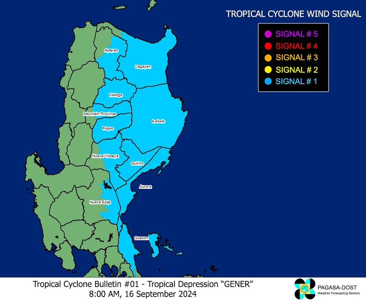
Following this development, Pagasa raised Tropical Cyclone Wind Signal Number 1 in the following areas:
Article continues after this advertisement- the eastern and central portions of mainland Cagayan: Piat, Santo Niño, Camalaniugan, Tuao, Lal-Lo, Enrile, Gonzaga, Alcala, Amulung, Santa Teresita, Baggao, Buguey, Solana, Rizal, Santa Ana, Tuguegarao City, Gattaran, Peñablanca, Iguig, Lasam, Aparri, Ballesteros, Allacapan, Abulug
- Isabela
- Quirino
- the eastern portion of Nueva Vizcaya: Alfonso Castaneda, Kasibu, Dupax del Norte, Quezon, Diadi, Bayombong, Ambaguio, Bagabag, Villaverde, Aritao, Bambang, Dupax del Sur, Solano
- the eastern and southern portions of Apayao: Conner, Flora, Pudtol, Santa Marcela, Luna, Kabugao
- Kalinga
- the eastern and central portions of Mountain Province: Paracelis, Sadanga, Bontoc, Natonin, Sabangan, Barlig
- Ifugao
- Aurora
- the eastern portion of Nueva Ecija: Carranglan, Pantabangan, Bongabon, Gabaldon, Laur, General Tinio, Rizal, General Mamerto Natividad, Palayan City
- the northern portion of mainland Quezon: General Nakar, Infanta, and Real including the Polillo Islands
Gener is forecast to land at either Isabela or Aurora within 24 hours.
It is expected to exit the country’s area of responsibility by Wednesday, September 18.