
MANILA, Philippines — Enteng intensified into a severe tropical storm on Tuesday afternoon, according to state meteorologists.
Enteng became a tropical storm at 2:00 p.m., the Philippine Atmospheric, Geophysical and Astronomical Services Administration (Pagasa) reported at 5:00 p.m.
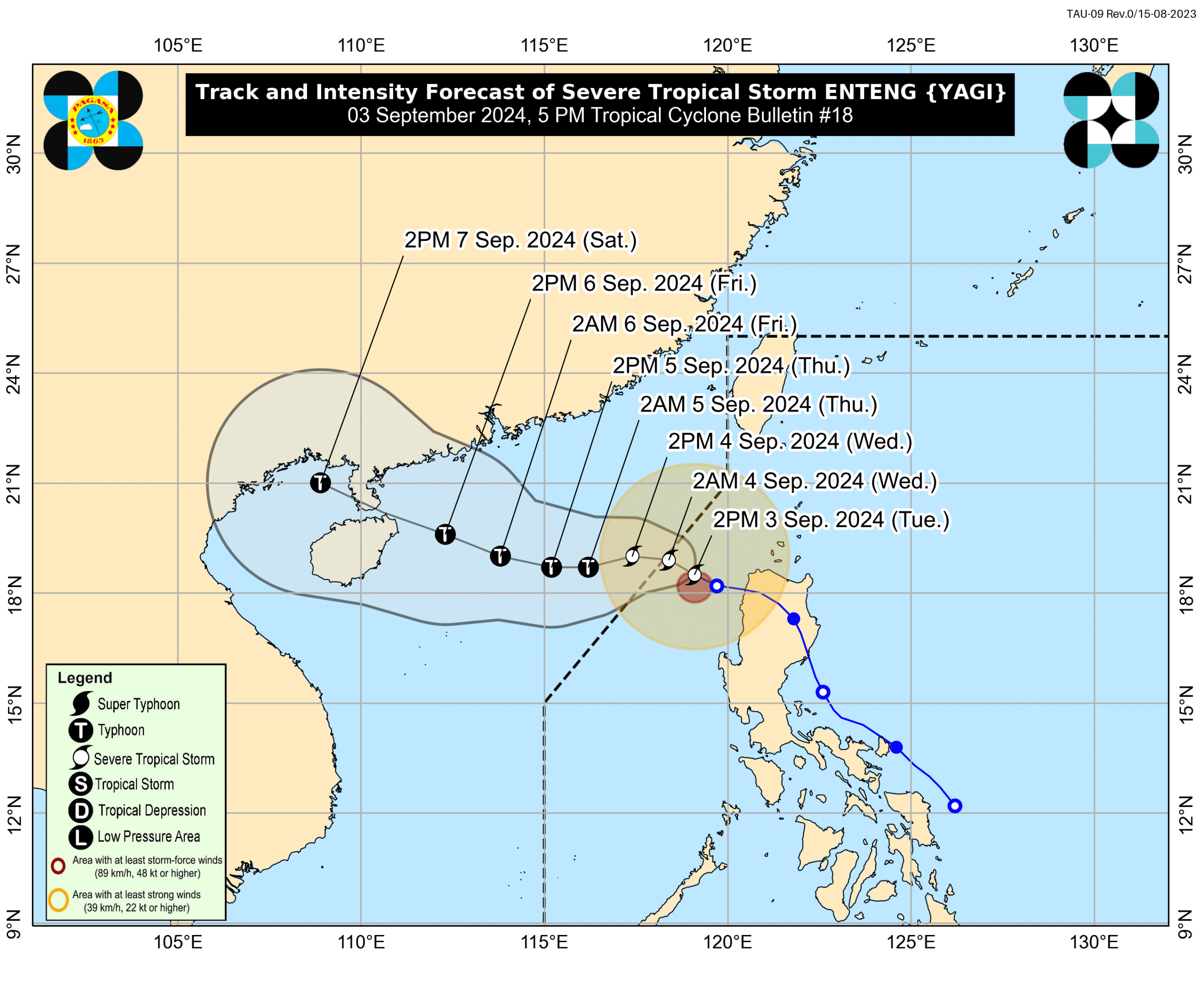
Pagasa said the severe tropical storm’s center was last spotted 165 kilometers west-northwest of Laoag City, Ilocos Norte, packing maximum sustained winds of 95 kilometers per hour (kph) near the center and gustiness of up to 115 kph.
Only four areas are under Tropical Cyclone Wind (TCWS) Signal No. 1.
LIVE UPDATES: Tropical Storm Enteng
Pagasa hoisted TCWS No. 1 in Ilocos Norte, Ilocos Sur, the northern portion of La Union, and Abra, where wind speeds of 39 kph to 61 kph are expected, causing minimal to minor threat to life and property.
The severe tropical storm will exit the Philippine area of responsibility (PAR) on Wednesday morning.
Enteng is seen to intensify throughout the forecast period and may become a typhoon on Thursday.
“The tropical cyclone may also reach its peak intensity by late Friday or early Saturday prior to making landfall in mainland China,” Pagasa said in its report.
Outside the PAR, the tropical storm will move generally westward until Friday morning, then turn west-northwestward for the remainder of the forecast period.
It is expected to make another landfall in the vicinity of southern mainland China during the weekend.
READ: Enteng to intensify into severe tropical storm