FOR EMERGENCIES: List of government hotlines
MANILA, Philippines — Tropical Cyclone Carina developed into a super typhoon on Wednesday afternoon, according to the state weather bureau.
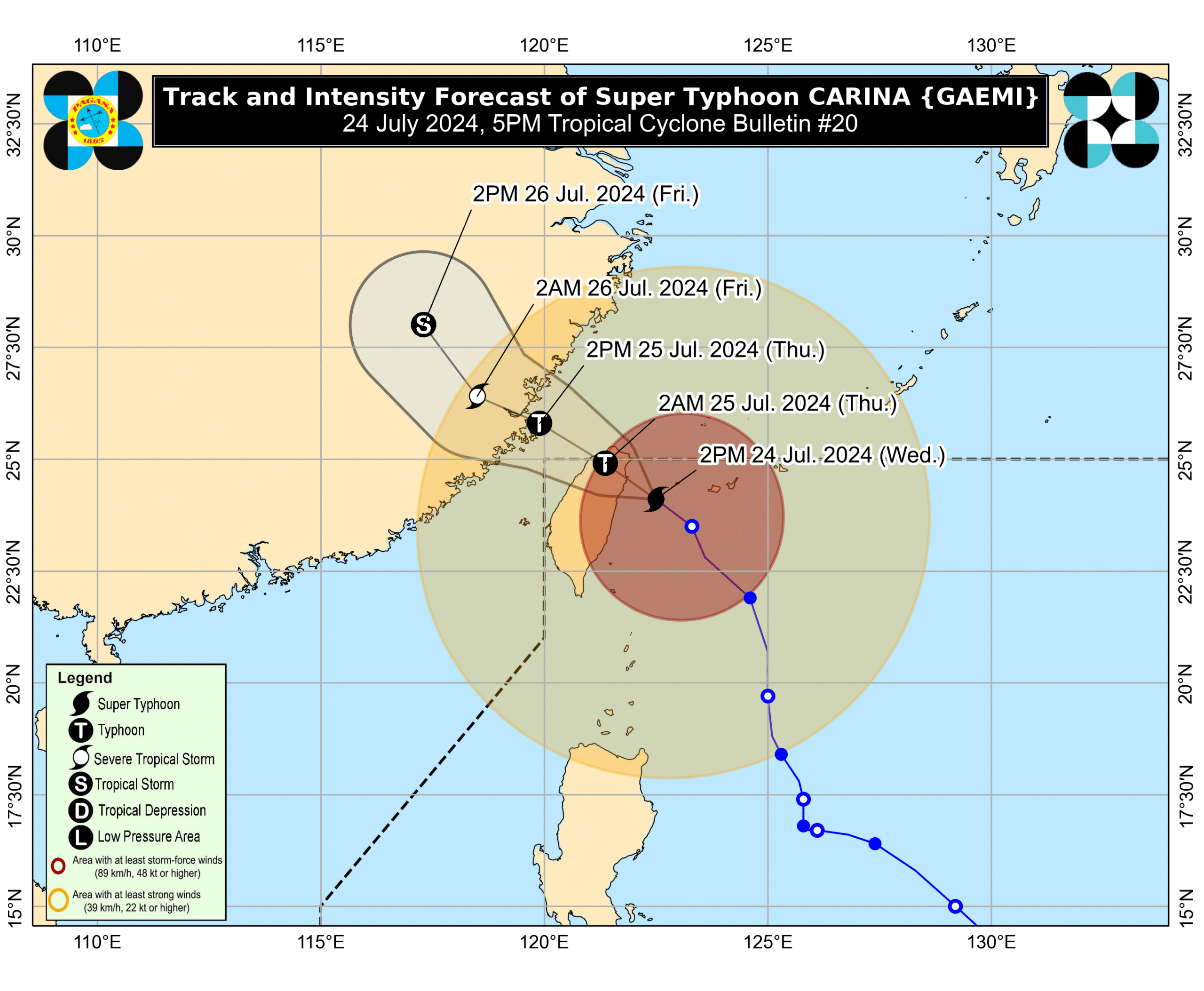
Carina’s center is currently located 380 km north of Itbayat, Batanes, packing maximum sustained winds of 185 kilometers per hour (kph) near the center with gustiness of up to 230 kph, according to the Philippine Atmospheric, Geophysical and Astronomical Services Administration’s (Pagasa) 5:00 p.m. update.
Pagasa said the super typhoon is forecast to make landfall over the northern portion of Taiwan on Wednesday evening.
READ: LIVE UPDATE: Typhoon Carina
“Carina has reached its peak intensity as Super Typhoon before its landfall over Taiwan due to favorable environment,” Pagasa said. “Its landfall over northern Taiwan will trigger a weakening trend for the rest of the forecast period.”
Batanes remains under Tropical Cyclone Wind Signal (TCWS) No. 2, where winds of greater than 62 kph and up to 88 kph may be expected in at least 24 hours, causing minor to moderate impacts to life and property.
Signal No. 1 is still up at the Babuyan Islands, the northern portion of Cagayan, and the northern portion of Ilocos Norte.
Areas under Signal No. 1 are expected to have 39 to 61 kph wind speed, which causes minimal to minor threat to life and property.
Carina is forecast to exit the Philippine area of responsibility on Thursday morning.
While not under any TCWS, Metro Manila is reeling from the onslaught of Super Typhoon Carina which is enhancing the southwest monsoon or habagat, according to the state weather bureau.
The deluge of the typhoon and weather system rendered many main thoroughfares in Metro Manila impassable, which led to thousands of motorists being stranded.
Tens of thousands of residents in Metro Manila were also evacuated as floods left entire bungalows submerged, with some even seeing floods in the second story of their houses.
READ: LIVE UPDATES: Typhoon Carina