Pagasa: Signal no. 1 may be raised in Extreme Northern Luzon on Sona day
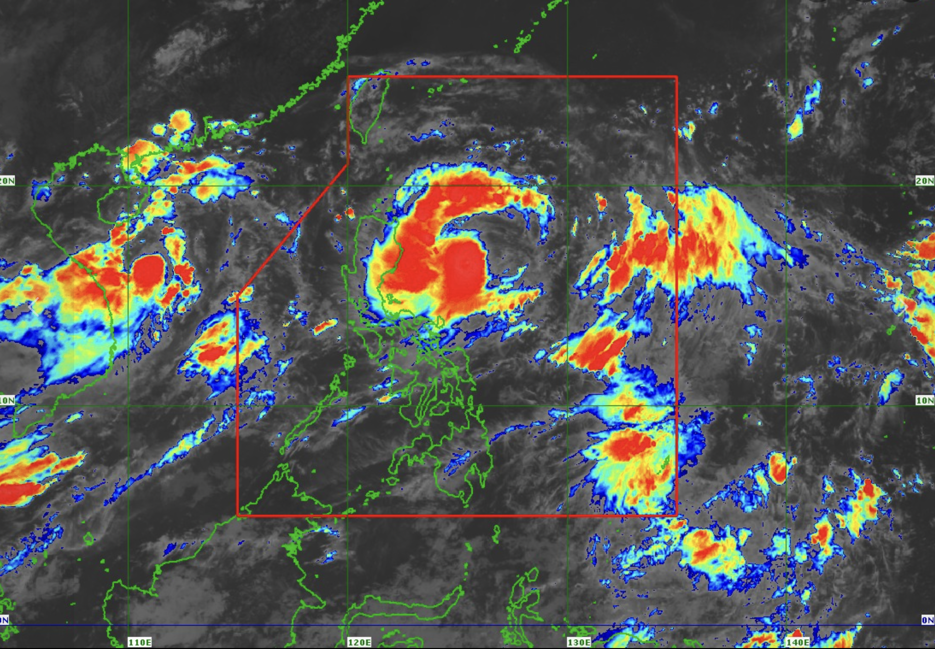
Satellite photo from Pagasa
MANILA, Philippines — The state weather bureau is not ruling out the possibility of raising storm signal no. 1 over some areas in Extreme Northern Luzon within the day or on Monday (July 22) when President Ferdinand Marcos Jr. will deliver his third State of the Nation Address (Sona).
This possibility is due to the effects of severe tropical storm Carina (international name: Gaemi).
In its 11 a.m. report, the Philippine Atmospheric, Geophysical and Astronomical Services Administration (Pagasa) said the southwest monsoon or habagat is also expected to enhance Carina and affect several areas nationwide until Wednesday.
READ: Pagasa forecasts light to moderate rains in Western Visayas
Article continues after this advertisement“The hoisting of wind signal no. 1 over Extreme Northern Luzon and northeastern portion of mainland Cagayan is not ruled out, possibly by tonight or tomorrow in anticipation of strong winds associated with Carina,” Pagasa reported.
Article continues after this advertisementOther places that may experience strong to gale-force gusts due to habagat and Carina are:
July 21 to July 22 (Sunday to Monday)
Mimaropa
Bicol Region
Western Visayas
July 22 to July 23 (Monday to Tuesday)
Zambales
Bataan
Metro Manila
Calabarzon
Mimaropa
Bicol Region
Visayas
July 23 to July 24 (Tuesday to Wednesday)
Ilocos Region
Central Luzon
Metro Manila
Calabarzon
Mimaropa
Bicol Region
Visayas
According to Pagasa, Carina slightly intensified and was last spotted 350 kilometers east of Casiguran in Aurora.
It is carrying maximum sustained winds of 85 kilometers per hour (kph) with gustiness of up to 115 kph.
Carina is moving westward at 20 kph.
Despite this development, Pagasa said no gale warning was raised in the any of the country’s seaboards.
“Over the Philippine Sea, Carina is forecast to move generally north northwestward to northward from today until Tuesday (23 July),” the state weather service said.
“On the track forecast, Carina will remain far from the Philippine landmass and exit the Philippine Area of Responsibility on Wednesday night (24 July) or Thursday early morning (25 July) while moving near the islands in the Ryukyu archipelago,” it added.