Pagasa: No tropical cyclone threat to PH in next few days
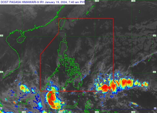
The Philippine Atmospheric, Geophysical and Astronomical Services Administration (Pagasa) says on Friday, January 19, 2024, that no tropical cyclone is seen forming or developing within and outside the Philippine area of responsibility. Weather satellite image from Pagasa
MANILA, Philippines — The country is marked safe from threats of a tropical cyclone in the next few days, based on the observations of the Philippine Atmospheric, Geophysical and Astronomical Services Administration (Pagasa).
In an early morning weather report, Pagasa expert Benison Estareja said: “Wala pa din po tayong nakikitang bagyo na papasok ng ating Philippine area of responsibility sa loob ng limang araw.”
(We have not yet seen any typhoons entering our Philippine area of responsibility within five days.)
Estareja likewise said the effects of the shear line and northeast monsoon, locally known as amihan, are weakening. However, overcast skies and rains may still be possible in several areas of the country due to the two weather systems, he added.
“Humihina na po ang epekto ng shear line o ang linya kung saan nagtatagpo ang malamig na amihan at mainit na easterlies dito sa malaking bahagi ng Mindanao kung saan nagkaroon ng minsang malakas na pag-ulan [nitong Huwebes],” Estareja said.
Article continues after this advertisement(The effect of the shear line or the line where the cold north and warm easterlies meet is weakening here in a large part of Mindanao where there was some heavy rain this Thursday.)
Article continues after this advertisement“Samantala, ito namang northeast monsoon o amihan ay bahagya ding humihina at nakakaapekto na lamang sa malaking bahagi ng Luzon,” he added.
(Meanwhile, this northeast monsoon or amihan is also slightly weakening and is only affecting a large part of Luzon.)
READ: Pagasa: Northeast monsoon bringing cold mornings to Luzon, Visayas
According to Pagasa, the shear line is seen to cause cloudy skies with scattered rain showers and thunderstorms in Caraga and Davao Region, while overcast skies with light rains may be expected in Cagayan Valley and Aurora because of the weak northeast monsoon.
The northeast monsoon was also dominant over Metro Manila, Ilocos Region, Cordillera Administrative Region, Calabarzon Cavite, Laguna, Batangas, Rizal, and Quezon), Bicol Region, and the rest of Central Luzon where partly cloudy to cloudy skies with isolated rain showers or thunderstorms may be anticipated.
On Friday, partly cloudy to cloudy skies with isolated rain showers or thunderstorms may occur in other country areas.
The effects of the northeast monsoon also prompted Pagasa to raise a gale warning over the eastern seaboards of the country, specifically in Southern Luzon (the northern and eastern coasts of Catanduanes, Albay and Sorsogon), Visayas (Northern Samar, eastern coast of Eastern Samar), and Mindanao (eastern coast of Dinagat Islands, Surigao Del Norte, Surigao Del Sur, and Davao Oriental).
Rough to very rough seas with 2.8 to 4.5 meters of waves within 30 nautical miles from the coast were forecast in these areas.
“Sea travel is risky for small seacrafts; mariners of these vessels are advised to remain in port or seek safe harbor,” Pagasa said in its 5:00 a.m. advisory.
“For larger vessels, operating in these conditions required experience and properly equipped vessels,” it added.