TD Kabayan keeps strength; Signal No. 1 still up in VisMin areas
Know the latest on Tropical Depression Kabayan through our LIVE UPDATES
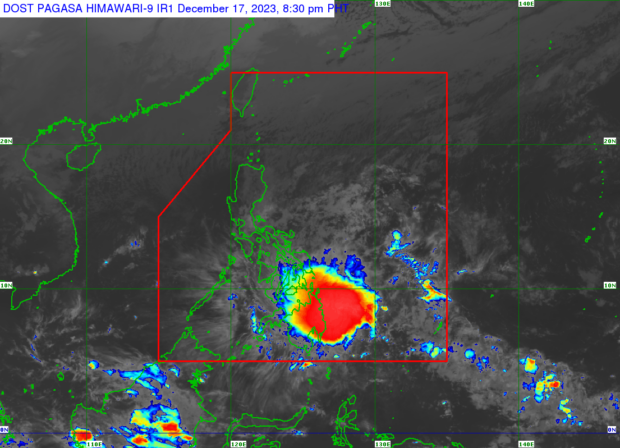
MANILA, Philippines — Tropical depression Kabayan has kept its strength as it accelerates westward over the Philippine Sea, the state weather bureau reported on Sunday evening.
In its 8 p.m. cyclone bulletin, the Philippine Atmospheric, Geophysical and Astronomical Services Administration (Pagasa) said Kabayan was last spotted some 290 kilometers (kms) east of Southeast Hinatuan, Surigao del Sur, moving 10 kms per hour (kph).
The tropical depression carries maximum sustained winds of 55 kph with gustiness of up to 70 kph.
Although it maintained its power and as it gets closer to landmass, Pagasa said the Tropical Cyclone Wind Signal Number 1 remained hoisted in the following areas:
Visayas
Southern Leyte, Leyte, the southern portion of Samar (Basey, Santa Rita, Marabut, Talalora, Villareal, Pinabacdao), the south portion of Eastern Samar (Maydolong, City of Borongan, Quinapondan, Guiuan, Lawaan, Balangiga, Llorente, Giporlos, Salcedo, Balangkayan, General Macarthur, Hernani, Mercedes), Cebu including Camotes Islands, Bantayan Islands, Bohol, and Siquijor
Mindanao
Dinagat Islands, Surigao del Norte, Surigao del Sur, the northern portion of Davao Oriental (Cateel, Boston, Baganga, Manay, Caraga), Agusan del Norte, Misamis Oriental, Camiguin, Bukidnon, Agusan del Sur, Davao de Oro, Misamis Occidental, Lanao del Norte, Lanao del Sur, the northern and central portion of Davao del Norte (Santo Tomas, New Corella, Braulio E. Dujali, City of Panabo, Asuncion, City of Tagum, Talaingod, Carmen, Kapalong, San Isidro), Davao City, the northern portion of Cotabato (Arakan, Carmen, Banisilan, Alamada, President Roxas, Kabacan, Matalam, Antipas, Magpet), and the north portion of Maguindanao (Buldon, Barira, Matanog)
READ: TD Kabayan may hit Surigao del Sur or Davao Oriental, says Pagasa
Kabayan is expected to maintain its power until its initial landfall along the coast of Surigao del Sur or Davao Oriental tonight or tomorrow morning, the agency’s bulletin further said.
READ: Kabayan maintains strength, may cause heavy rainfall in Southern Luzon
“Due to frictional effects associated with landfall, Kabayan is forecast to weaken over land, and the possibility of being downgraded into a low-pressure area, while over land or after emerging over the sea is not ruled out,” Pagasa added.
The tropical depression is also expected to make another landfall over central or southern Palawan Tuesday morning.
Meanwhile, the state weather bureau reported that the combined effects of Kabayan and shear line may bring heavy rain over the eastern portion of Southern Luzon for the rest of the night and over the eastern part of Luzon on Monday.