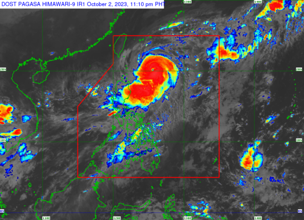
MANILA, Philippines — Typhoon Jenny (international name: Koinu) further intensified on Monday night, prompting the state weather bureau to raise tropical cyclone wind signal no. 2 in the island of Batanes.
According to Pagasa’s latest typhoon bulletin, Jenny was last spotted 410 kilometers (km) east of Basco, Batanes carrying wind speeds of 165 km per hour (kph) and gusts of up to 205 kph.
Jenny continues to move northwestward at 10 kph.
Signal No. 2 (gale-force winds with minor to moderate threat) prevails over Batanes while Signal No. 1 (strong winds with minimal to minor threat to life and property) is raised on the following areas:
- Cagayan including Babuyan Islands
- The northern and eastern portions of Isabela (Maconacon, Divilacan, Palanan, Santa Marla, San Pablo, Tumauini, Cabagan, llagan, San Mariano, Santo Tomas, Dinapigue, Benito Soliven, Naguillan, Gamu, Quirino, Delfin Albano, Quezon, Mallig)
- Apayao
- The northern and central portions of locos Norte (Carasi, Vintar, Burgos, Dumalneg, Bangui, Pagudpud, Adams, Nueva Era, Pasuquin, Bacarra, Laoag, San Nicolas, Sarrat, Piddig, Dingras, Solsona, Marcos)
- The northeastern portion of Abra (Tineg, Lacub, Malibcong)
- The northern portion of Kalinga (Balbalan, Pinukpuk, Rizal, Tabuk)
- Ilocos Norte
Pagasa then warned residents in Batanes, Babuyan Islands, and the northeastern portion of mainland Cagayan of heavy rainfall, expected to accumulate 50 to 100 millimeters in total.
Typhoon Jenny is expected to exit the Philippine area of responsibility by Thursday afternoon as it moves northwestward or west northwestward.
Southwest Monsoon
Meanwhile, the typhoon-enhanced southwest monsoon (locally known as “habagat”) will bring gusty conditions over Aurora, Bataan, Bulacan, Metro Manila, Calabarzon, Bicol Region and most of Mimaropa and Western Visayas in the next three days, said Pagasa.
Heavy rainfall caused by habagat, accumulating to 50 to 100 millimeters, is also forecast over Occidental Mindoro, Palawan and Western Visayas until Tuesday night.
