The southwest monsoon, locally known as habagat, will bring overcast skies and rains in many parts of the Philippines on Wednesday, September 13, 2023, due to the southwest monsoon, locally known as habagat, according to the state weather agency. Photo from Pagasa’s Facebook page
MANILA, Philippines — Overcast skies and rains will be experienced in many parts of the country, including Metro Manila, on Wednesday due to the southwest monsoon, locally known as habagat, the state weather agency said.
The Philippine Atmospheric, Geophysical and Astronomical Services Administration (Pagasa) noted that the southwest monsoon is the dominant weather element influencing climate conditions in the country now following consecutive typhoons that affected thousands.
“Magiging maulap ang kalangitan at mataas din ang tyansa ng pag-ulan, pagkidlat, at pagkulog dulot ng habagat dito sa bahagi ng Metro Manila, nalalabing bahagi pa ng Central Luzon at Calabarzon, maging dito sa bahagi ng Mimarop (Mindoro, Marinduque, Romblon, and Palawan),” said Pagasa weather specialist Grace Castañeda.
(The sky will be cloudy and there is also a high chance of rain, lightning, and thunder caused by the southwest monsoon here in Metro Manila, the rest of Central Luzon and Calabarzon, even here in Mimaropa.)
Cloudy skies with scattered rain showers and thunderstorms will also prevail in La Union, Pangasinan, Benguet, Zamboanga Peninsula, Bangsamoro Autonomous Region in Muslim Mindanao, and Soccsksargen (South Cotabato, Cotabato, Sultan Kudarat, Sarangani, and General Santos City) due to the southwest monsoon.
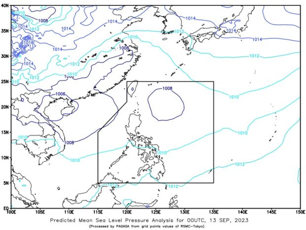
The southwest monsoon, locally known as habagat, will bring overcast skies and rains in many parts of the Philippines on Wednesday, September 13, 2023, due to the southwest monsoon, locally known as habagat, according to the state weather agency. Image from Pagasa website
Meanwhile, the trough or extension of the low-pressure area (LPA) last spotted 610 kilometers east of Itbayat, Batanes, will bring cloudy skies and scattered rains over the eastern parts of Central and Southern Luzon, particularly in the Bicol Region, Aurora, and Quezon.
The LPA remains within the Philippine area of responsibility, but the possibility of it developing into a cyclone is still low, Castañeda said.
As for the rest of the country, Pagasa said partly cloudy to cloudy skies with isolated rain showers or thunderstorms will occur on Wednesday.
It warned of possible flash floods or landslides due to moderate to, at times, downpours.
“Huwag pa rin po natin kalilimutan ‘yung mga pananggalang natin dito sa mga pag-ulan na ito (Let’s not forget our protections from the rain),” Castañeda said.
Pagasa did not raise any gale warning over any part of the country’s seaboard.
RELATED STORIES
Pagasa: Rain in parts of PH due to LPA trough, southwest monsoon
Pagasa: Rain in parts of Luzon, fairer weather in Vis-Min
Two LPAs on Pagasa’s radar; one already inside PAR