Two LPAs on Pagasa’s radar; one already inside PAR
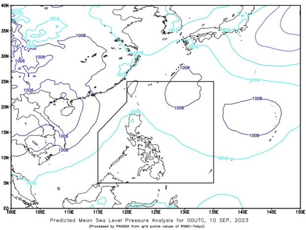
The state weather bureau says on Sunday, September 10, 2023, that two low pressure areas are being monitored inside and outside the Philippine areas of responsibility: the first is located 730 kilometers east-northeast of Itbayat, Batanes, while the second is spotted 2,025 kilometers east of southeastern Luzon. Photo from Pagasa’s Facebook page
MANILA, Philippines — The state weather agency is monitoring two low pressure areas (LPAs) inside and outside the Philippine area of responsibility (PAR).
One of the two entered PAR at 3 a.m. on Sunday, the Philippine Atmospheric, Geophysical and Astronomical Services Administration (Pagasa) added.
State weather specialist Daniel James Villamil said the first was located 730 kilometers east-northeast of Itbayat, Batanes, while the second was spotted 2,025 kilometers east of southeastern Luzon.
“Sa kasalukuyan ay dalawang LPA ang ating mino-monitor sa loob at labas ng ating PAR. Una itong LPA sa loob ng ating PAR, kaninang alas-tres ng umaga huli itong namataan sa layong 730 kilometers silangan hilagang silangan ng Itbayat, Batanes. Ito namang LPA sa labas ng ating PAR kanina ring alas-tres ng umaga ang last location nito ay 2,025 kilometers silangan ng southeastern Luzon,” said weather specialist Daniel James Villamil.
Article continues after this advertisement(We are currently monitoring two LPAs inside and outside our PAR. The first is this LPA inside our PAR, which was located 730 kilometers east-northeast of Itabayat, Batanes, as of 3 a.m. Meanwhile, the other LPA’s last location outside PAR , also as of 3 a.m., was 2,025 kilometers east of southeastern Luzon.)
Article continues after this advertisementBut the two LPAs have no direct impact on any part of the country as it is forecast to move eastward, Villamil also said.
Pagasa further said the two LPAs are not likely to develop into a tropical depression within the next 24 to 48 hours.
Meanwhile, the southwest monsoon, locally known as habagat, will continue to affect the western sections of north and central Luzon, Villamil noted.
Hence, overcast skies with scattered rain showers and thunderstorms may be expected in Batanes and Babuyan Islands while partly cloudy to cloudy skies with isolated rain showers or thunderstorms will prevail over Metro Manila and the rest of the country.
The southwest monsoon is seen to bring moderate to at times heavy rains, so Pagasa warned residents in affected areas of possible flash floods and landslides.
RELATED STORIES
Fair weather expected but weak habagat still affects parts of Luzon
Southwest monsoon to prevail over parts of Northern and Central Luzon – Pagasa
LPA forms inside PAR, to become 1st tropical cyclone in September