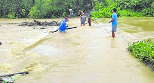
IMPASSABLE | Residents remove debris from the flooded Mocag Bridge in Baggao, Cagayan province, in this photo taken on Tuesday, Aug. 29, 2023. The widespread flooding spawned by Typhoon Goring (international name: Saola) in the province also damaged other bridges and some schools. (Photo from the Baggao Disaster and Risk Reduction Management Office)
MANILA, Philippines — More than 408,000 people in 28 provinces have been affected by heavy rain and flooding since Aug. 23, according to the National Disaster Risk Reduction Management Council (NDRRMC).
The displacements in eight regions were due to the combined effects of the southwestern monsoon along with Typhoon Goring (international name: Saola) — which entered the Philippine Area of Responsibility (PAR) on Aug. 23 and exited on Aug. 30 — and Typhoon Hanna (international name: Haikui), which is expected to remain in the PAR until Monday.
Both typhoons were still active with Goring headed for Hong Kong at 5 p.m. Saturday and Hanna still in the PAR but headed for Taiwan.
A total of 51,284 people were displaced and 22,391 were still in evacuation centers on Saturday morning, the disaster agency said.
The government estimates that it has provided P17.68 million in assistance to the displaced with more than P13 million coming from the Department of Social Welfare and Development.
The disaster agency said on Saturday that one person from Western Visayas was killed, another injured, and yet another still missing due to the effects of the typhoons and the prevailing southwest monsoon.
The NDRRMC reported that, so far, damage to infrastructure was at more than P130 million, excluding damage to agriculture.
Meanwhile, Hanna has continued to intensify, bringing heavy rain and strong winds, in the northern and western parts of the country.
In an advisory on Saturday afternoon, the Philippine Atmospheric, Geophysical and Astronomical Services Administration (Pagasa) reported Hanna to have maximum sustained winds of 140 kilometers per hour (kph) near the center, with gustiness of up to 170 kph.
Pagasa reported Hanna’s center at 375 km east northeast of Itbayat, moving west-northwestward at 20 kph.
Hanna continued to enhance the monsoon and is expected to continue dumping rain over the western portion of Luzon in the next three days.
Areas to be affected include Metro Manila and the entire Ilocos Region, as well as the provinces of Abra, Bataan, Batangas, Benguet, Bulacan, Cavite, Nueva Ecija, Pampanga, Rizal, Occidental Mindoro and Zambales.
The monsoon, meanwhile, is expected to bring gusty conditions in areas not under any wind signal, especially in coastal and upland or mountainous areas.
The weather bureau said Hanna was moving in a west-northwesterly direction and may hit the eastern coast of southern Taiwan on Sunday afternoon or evening before it weakens.
Based on its forecast track, Hanna will exit PAR on Monday morning and is expected to weaken further into a tropical depression by Wednesday or Thursday.

