Pagasa: Storm expected to enter PAR Wednesday, may become typhoon
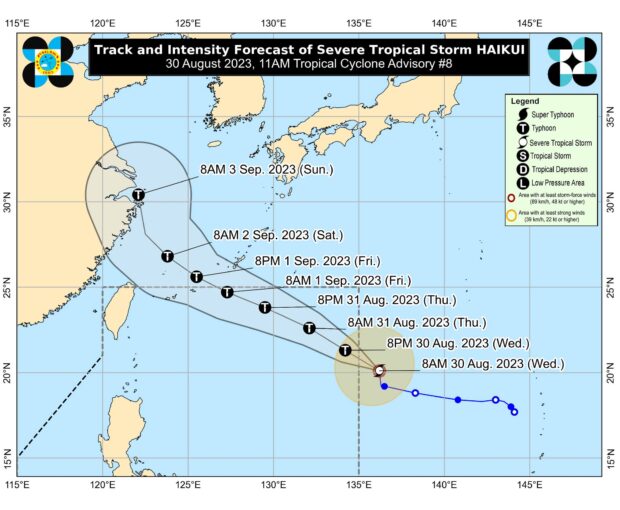
MANILA, Philippines – Severe Tropical Storm Haikui is expected to enter the Philippine area of responsibility (PAR) on Wednesday afternoon with the country still reeling from the effects of Typhoon Goring, according to the Philippine Atmospheric, Geophysical and Astronomical Services Administration (Pagasa).
“Haikui is forecast to move generally west-northwestward or northwestward throughout the forecast period and may enter the PAR this afternoon,” Pagasa said in its latest advisory.
Pagasa also said Haikui may become a typhoon upon entering PAR.
“It is forecast to become a typhoon within the PAR region and may reach its peak intensity on Friday as it approaches the boundary of the PAR,” Pagasa said.
The severe tropical storm’s center is 1,465 kilometers east of extreme Northern Luzon, packing maximum sustained winds of 110 kilometers per hour (kph) near the center and gustiness of up to 135 kph.
Article continues after this advertisementPagasa, however, said Haikui is forecast to remain far from the Philippine landmass and may exit PAR by Friday morning.
Once it enters PAR, the severe tropical storm will be called “Hanna.”