Signal No. 5 up over Babuyan Islands as Goring becomes super typhoon
MANILA, Philippines — Goring (international name: Saola) strengthened back into a super typhoon on Tuesday evening, prompting Signal No. 5 to be raised over the Babuyan Islands, the Philippine Atmospheric, Geophysical, and Astronomical Services Administration (Pagasa) said on Tuesday.
Signal No. 5 means life-threatening weather, Pagasa warned.
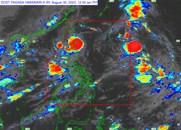
Goring was last spotted over the waters off Calayan in Cagayan, moving northwest at 10 kph with maximum sustained winds of 185 kph and gusts of up to 230 kph.
“It’s dangerous. The impact will be big and the wind force caused by Typhoon Goring will be very damaging, bringing with it very heavy rain,” Pagasa weather specialist Obet Badrina said in Filipino.
“It will continue to bring strong winds and rain, particularly in Batanes and Babuyan Islands from tonight until tomorrow [Tuesday to Wednesday].”
The following wind signals were raised:
Signal No. 5 (typhoon-force winds with extreme threat to life and property)
northeast Babuyan Islands
Signal No. 4 (typhoon-force winds with significant to severe threat to life and property)
southern Batanes: Sabtang, Uyugan, Ivana, Mahatao, and Basco
northwestern and southeastern Babuyan Islands
Signal No. 3 (storm-force winds with a moderate threat to life and property):
the rest of Batanes
the rest of the Babuyan Islands
the extreme northeastern portion of mainland Cagayan: Santa Ana)
Signal No.2 (gale-force winds with a minor to moderate threat to life and property):
northern and eastern Cagayan: Gonzaga, Santa Plaxedes, Claveria, Sanchez Mira, Pamplona, Abulug, Ballesteros, Aparri, Buguey, Camalaniugan, Santa Teresita, Allacapan, Lal-Lo, Lasam, Gattaran, Baggao, and Peñablanca
northern Ilocos Norte: Pagudpud, Adams, Bangui, Dumalneg
northern Apayao: alanasan, Luna, Santa Marcela, Flora, and Pudtol)
Signal No. 1 (strong winds with a minimal to minor threat to life and property)
northern and eastern Isabela: Dinapigue, San Mariano, Ilagan City, Tumauini, San Pablo, Cabagan, Maconacon, Divilacan, Palanan, Santa Maria, Santo Tomas, Quezon, and Delfin Albano
rest of Ilocos Norte
rest of Cagayan
rest of Apayao
northern Abra: Tineg, Lagayan, Lacub, and Malibcong
northern Kalinga: Balbalan, Pinukpuk, Rizal, Tabuk)
Pagasa said Goring would either “pass very close” or make landfall in the vicinity of the Babuyan Islands and Batan-Sabtang Islands in Batanes between Tuesday evening and Wednesday afternoon.
Heavy rainfall ranging greater than 200 millimeters (mm) should be expected in Babuyan Islands and Batanes, while rainfall from 50 to 100 mm may persist in Ilocos Norte, the northern portion of Abra, the northern portion of Apayao, and the northwestern portion of mainland Cagayan.
Pagasa also warned of heavy rainfall ranging from 50 to 100 mm in the northeastern portion of mainland Cagayan, Abra, Ilocos Sur, and the rest of Apayao.
Goring is expected to exit the Philippine area of responsibility by Wednesday or Thursday morning.