
Image from Pagasa
MANILA, Philippines — The tropical storm outside the Philippine area of responsibility (PAR) is keeping its strength as it accelerates north-northwestward, the state weather bureau reported on Friday.
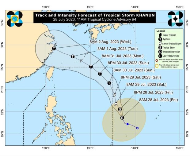
At 11 a.m., the Philippine Atmospheric, Geophysical and Astronomical Services Administration (Pagasa) reported tropical storm Khanun was 1,345 kilometers east of Eastern Visayas.
It has increased its speed to 25 kilometers per hour (kph), carrying maximum sustained winds of 65 kph and gustiness of up to 80 kph.
Khanun will be named Falcon once it enters PAR by Saturday evening or Sunday morning.
The tropical storm can become a typhoon before entering PAR.
Although Khanun is forecast to strengthen in the coming days, but Pagasa said it will unlikely hoist wind signals anywhere.
However, it is predicted to enhance the southwest monsoon or “habagat,” which may bring occasional or monsoon rains to western parts of Luzon and the Visayas beginning Saturday or Sunday (July 30).
RELATED STORIES:
Tropical depression outside PAR develops into tropical storm – Pagasa
Pagasa lifts all wind signals as Egay moves away from PAR